Showing posts with label Boxing Day. Show all posts

Saturday, 30 November 2024

Rochdale Canal Overflows in Sowerby Bridge

The 2015 Boxing Day floods marked a turning point for Sowerby Bridge, a town accustomed to the gentle rhythm of its waterways. For the first time in generations, the Rochdale Canal, once a vital artery of the local economy, was overwhelmed. The canal's banks gave way, flooding the towpath and inundating the locks. This historic event, coupled with the devastating impact of the Rivers Ryburn and Calder, forever etched itself into the town's memory.

These Polaroid photographs, preserved in timeless black and white, serve as a poignant reminder of the 2015 Boxing Day floods. The monochromatic format lends a historical and almost melancholic quality to the images, underscoring the enduring impact of this natural disaster.


The pictures displayed here are all in 900 x 600 x 150 resolution. Clicking any image should open a link in another window to my Colin Green Zazzle store where 6 x 4 x 300 prints are available for a small fee. This can be edited and added to additional products of your choosing.

Thanks for looking, all the pictures remain the copyright of Colin Green.


All links will open in another window.

Tuesday, 6 December 2022

Boxing Day Randoms.

 A set here I took using a Samsung Galaxy Tablet on Boxing Day 2013, whilst out for a walk blowing away the Christmas Day cobwebs. Not much to add only they were taken in the Sowerby Bridge to Luddendenfoot area.


I've never discovered much about this building, it can be found by following a path from Tenterfields in the direction of Boulderclough and Luddendenfoot. I was once told it was part of Sagar Richards, which was an engineering company that occupy a sight to the north of the railway which passes to the right of the picture. There's no obvious signs that the sites were connected at the railway crossers a low bridge to the west of here which would have restricted access to larger vehicles.


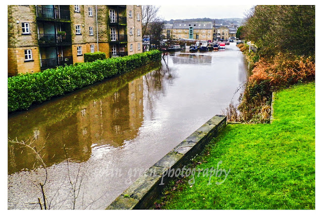
This former mill pulley is on display in an apartment complex that occupies the former mills in the centre of Sowerby Bridge. Dugdales Mill can be seen in the background.


This stream runs through a private garden at Rose Grove to the west of Sowerby Bridge, the stream runs underneath the road in to the Rochdale Canal.


This former mill chimney long since disused offers a striking site in the centre of Sowerby Bridge, the road that runs past is the Old Cawsey an ancient packhorse route that was once the main road through the valley and Sowerby Bridge.


The 3 pictures above show Monkey Tunnel (no idea why it's called that). The tunnel runs underneath the railway line near Tenterfields Business Park.


Now offices and apartments this building was once the boiler house that helped Sowerby Bridge power that industry that built it from a hamlet alongside the River Calder into a town.


These rusty gates can be found near Trinity Academy, Sowerby Bridge, they were probably once one of the entrances to the school grounds, they have long since ceased to be used and have been left to rot, rust and decay.


This water culvert carries a water source from Sowerby underneath the railway in to the River Calder, it can be found near the red brick abandoned mill pictured earlier.


Willow Hall Drive is a private road that takes it's name from the nearby manor house. Despite being a private road it is accessible to cars and pedestrians.


The tree lined partially covered path leads up from the Hollins Mill area to the Friendly area of Sowerby Bridge.

Thanks for looking and please take a moment to share and follow me on social media.

Clicking any image should open a link in another window to the higher resolution version on Clickasnap.

All the pictures remain the copyright of Colin Green.

Saturday, 8 October 2022

Sowerby Bridge, Boxing Day Floods 2015

 The following pictures which I recently rediscovered were taken of high water levels around Sowerby Bridge during the Boxing Day 2015 flooding that devastated the Calder Valley. This was the worst flooding to hit Sowerby Bridge since the 1960's with millions of pounds in property damage along the route of devastation along the River Calder from Todmorden to Mirfield and beyond. Mytholmroyd and Hebden Bridge suffered a lot more than Sowerby Bridge with the floods but living in Sowerby Bridge it was easier to picture some of the water levels here.

These pictures were taken using a Polaroid is2132 bridge camera on the 26th December 2015. They can be seen below and on Clickasnap full size, resolution and un-watermarked. Copies can also be purchased their if required.

The flooded Calder & Hebble Navigation and Rochdale Canals from Chain Bridge.

The Calder & Hebble overflowing at Chain Bridge.

Rochdale Canal from Tower Hill Bridge. The towpath can normally be seen to the
right of the canal, the small wall probably prevented the car park and nearby town
centre from further damage.

Tuel Lane Lock gates flowing over.

The River Calder flowing past Kingfisher Chase towards Lockhart Mills. The levels is
normally 15 - 20ft lower than this.

The flooded Kirkham Turn. This is where the Rochdale canal joins the Calder &
Hebble Navigation.

Flooding at Tuel Lane Lock on the Rochdale Canal.

Very High River Calder flowing past the Weaving Shed Apartments (right of picture) and
Dugdales Mill left of picture. Dugdales was severely flooded during this event.

River Calder at Gas Works Bridge, considering the damage done to Cromwell, Copley and
Elland Bridges, I was surprised that Gas Works Bridge still stood after the floods.

River Calder at Gas Works Bridge, looking more like a dam head than river crossing.

High level River Calder at Lockhill Mill, much of the red brick building was damaged beyond
repair by the flood and demolished the year after.

River Calder from above the Turks Head Beer Garden, the lower half of the iron footbridge
was just in to the flooded area. Dugdales mill storage yard can be seen heavily
flooded in the background.

Thanks for looking and please take a moment to share and follow me on social media.

All the pictures remain the copyright of Colin Green.

Monday, 24 December 2018

Sowerby Bridge Floods, 3 Years Later

Boxing Day 2015 saw flooding devastate the Calder Valley from Todmorden through to Brighouse, including my home town of Sowerby Bridge. I took a small set of pictures then of the ongoing flooding and with time to pass this morning, I thought I would return to roughly the same area and re picture some of them. The pictures below can only be seen on this blog post, however clicking any image should open a link in another window to my Clickasnap Profile.


Thanks for looking, please take a moment to share and follow me on social media.

All the pictures remain the copyright of Colin Green.

Through a Glass, Darkly: Hebden Bridge Railway Station in Negative

 There's something hauntingly beautiful about old photographs, especially when they're presented in a way that flips our perception....