Showing posts with label Calder and Hebble Navigation. Show all posts

Saturday, 29 March 2025

Bridge to Bridge: The Calder & Hebble from Mearclough and Copley

During a pleasant walk along the Calder & Hebble Navigation on May 7th, 2017, the following images were taken, capturing the serene natural beauty accessible just moments from a busy West Yorkshire town, a testament to the canal's unique charm

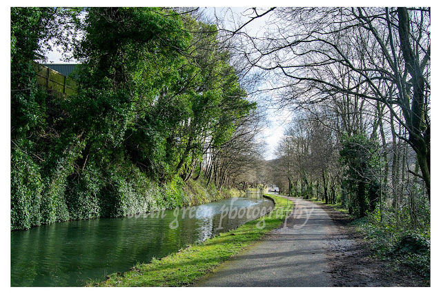
The first image, looking down the Calder & Hebble Navigation from Mearclough Bridge, it's hard to imagine the industrial heart that once pulsed here. This photograph, taken on May 7th, 2017, showcases a scene of pastoral tranquility, a world transformed from its working past. Where once the towering Canal Mills dominated the landscape, now nature reigns, softening the edges and creating a haven of green. The still waters reflect the verdant foliage, a stark contrast to the smoke and clamour that would have filled the air just decades ago. This image is a testament to the resilience of nature and the quiet beauty that has reclaimed this historic waterway.

Our journey continues along the towpath, where the tranquil ribbon of the canal is bordered by the vibrant green trees banking the expanse of Copley's playing fields. This next quartet of images captures a slice of time along this stretch, a place where the echoes of playful shouts and the quiet lapping of water create a unique harmony. Dominating the scene, and a silent sentinel of this landscape, is the venerable footbridge. For over a century and a half, its sturdy frame has spanned the canal, a testament to Victorian engineering and enduring craftsmanship. Imagine the countless journeys it has witnessed: the clatter of clogs on its wooden planks, the hushed whispers of lovers pausing to gaze at the still water, the steady passage of working boats laden with goods. Each rusted rivet and weathered beam holds a story, a whisper of the past. The bridge, more than just a crossing, is a living artifact, a stoic guardian watching over the canal's ever-flowing narrative. The play of light and shadow across its aged structure, the way it frames the landscape, and the subtle textures of its timeworn surfaces all contribute to a visual tapestry that speaks volumes about the passage of time and the enduring presence of history in our everyday surroundings.


Clicking any image should open a link in another window to my Colin Green Photography store on Zazzle.

All the images can also be seen on my Clickasnap account, please take a moment to share and follow me on social media and check out my portfolio on Photo4Me via the link below.

All the images remain the copyright of Colin Green.

Wednesday, 29 May 2024

A Walk in Winter: The Calder and Hebble Navigation

These black and white photos capture the stark beauty of a winter scene along the Calder and Hebble Navigation. The path, blanketed in snow, winds its way alongside a still waterway. The trees lining the bank are bare, their branches reaching out like skeletal fingers towards the inky sky.

The absence of color in this photo only heightens the sense of tranquility. The world seems hushed, blanketed in a peaceful silence. Footprints visible in the snow are likely those of lonely hikers, making the viewer feel as though they are a remote person in this isolated landscape.

The Calder and Hebble Navigation is a 21-mile canal in West Yorkshire, England. It was built in the late 18th century to connect Sowerby Bridge with Wakefield. Today, the canal is a popular spot for walking, cycling, and boating.

This photo is a reminder that even in the depths of winter, there is beauty to be found in the natural world. The stark contrast of the black and white tones highlights the simple elegance of the scene. The stillness of the river and the bare branches of the trees create a sense of peace and tranquility.

If you're looking for a place to escape the hustle and bustle of everyday life, the Calder and Hebble Navigation is a great option. A walk along the canal towpath is a chance to connect with nature and appreciate the beauty of the season, whatever the weather.

In addition to its natural beauty, the Calder and Hebble Navigation is also steeped in history. The canal was an important transportation artery during the Industrial Revolution, and there are a number of old mills and warehouses along its banks. Today, these buildings have been converted into homes, businesses, and arts centers.

Whether you're interested in history, nature, or simply looking for a place to relax, the Calder and Hebble Navigation is a great place to visit. So next time you're in West Yorkshire, be sure to take a walk along this historic waterway. You might just be surprised by the beauty you find.

The pictures below were taken on the 17th January 2016 with a Nikon D3300 Camera, they can also be seen in a higher resolution on Clickasnap, by simply clicking any of the images. All will open in another window.

The canal pictured looking away from Walker Lane Bridge towards Chain Bridge. The Sowerby Bridge Gas Works and Gasometers used to occupy a site to the left of the picture just beyond the trees, the gasometers have long since been removed.

The canal is pictured here between Hollas Lane Bridge (Sterne Mills Bridge) and Edwards Road Bridge (Canal Mills Bridge). Both Bridges tend to known by either name, the land to the left of the picture has been redeveloped in to Copley Valley a mixed use zone of housing, industry and nature areas since this picture was taken. The land to the right of the picture may also face redevelopment in the coming years, it was for a number of years a car park for the Halifax Bank's Copley Data Centre, this has been closed for a while now with the data set to close and be sold off in the near future.

The canal towards Mearclough Canal Bridge, the waterway narrows a little here, often wondered why.

Clicking any image should open a link to the version on Clickasnap. Various images and products of mine are avaliable to view and purchase from the sites below, clicking any link will open in another window.

All the images remain the copyright of Colin Green.


The following images are the colour versions of the pictures,


Wednesday, 20 September 2023

Halifax Branch Canal Artworks

 Halifax Branch Canal artworks is a set of 6 pictures of the Calder & Hebble Navigation spur towards Halifax from Salterhebble Locks. They are digital creations of prints showing various points along the what remains of the canal that used to run up towards the Halifax.

The Halifax Branch of the Calder & Hebble canal is an approx. half mile waterway that stretchers from Salterhebble junction / locks to the Watermill bar at Salterhebble Wharf.

The canal opened in 1828 and rose through 14 locks to end at Bailey Hall close to where the train station and Eureka museum now stands. The Halifax Branch fell in to disuse with the rise of firstly railways and the road transport and the section from Salterhebble Wharf to Bailey Hall was abandoned in 1942 and this has now become a cycle / pedestrian route known as the Hebble Trail with a little evidence that it was once a canal.

These artworks are based on photographs I took in November 2013 with a Samsung Galaxy Tablet.


The 3 pictures above show the canal around Wakefield Road Bridge, which is the first crossing over the canal after it branches off from the main waterway at Salterhebble Locks.


The canal was being worked on when the original picture was taken and had been drained beyond the lamp post on the tow path.


The drained canal at Salterhebble Basin.


The canal again at Salterhebble Basin, the Watermill Bar stands on the site of the demolished Salterhebble Mill.

Clicking any image should open a link in another window to the version on Clickasnap.

Thanks for looking, please take a moment to share and follow me on social media.

All the pictures remain the copyright of Colin Green.

Sunday, 3 September 2023

The Calder and Hebble Navigation. Ravensthorpe to Mirfield

 The Calder and Hebble Navigation is an inland waterway connecting Sowerby Bridge with Wakefield, West Yorkshire. Opened in 1770 to extend the navigational parts of the River Calder, the canal runs through 27 locks on its 21.5 mile journey from the canal basin at Sowerby Bridge to it's junction with the Aire and Calder Navigation at Fall Ings Lock, Wakefield. The canal unlike many others has never fallen out of use, with commercial traffic still using the canal until 1981, and leisure traffic increasing since the reopening of Tuel Lane lock and tunnel at Sowerby Bridge in 1996.

The pictures below were taken on the canal between Ravensthorpe Bridge and Bull Bridge, Mirfield. This stretch includes sections of cutting and river that are navigable. They were taken on the 8th April 2015 with a Polaroid is2132 camera.


This was taken just past Ravensthorpe Bridge looking in the direction of Mirfield. The navigation is on the River Calder at the moment.


The canal is still on the River Calder, the lock seen in the middle of the picture is Greenwood Lock. The lock allows traffic to leave the river section and enter Greenwood Cut.


This agian shows part of the River Calder section of the navigation, Greenwood cut is just off picture to the left.


This weir can be found at the top of Greenwood Cut End just before Shepley Bridge Marina. The canal ane river are a joint navigation for a short spur here. 


Shepley Bridge. This section of the navigation is a river and canal joint bit, the canal bears off through Shepley Lockseen near the centre of the picture underneath the bridge. The River Calder continuing beyond.


Shepley Bridge Marina, Nr Mirfield.


Shepley Bridge Marina and Lock.


Wheatley Bridge, Mirfield.


The abutments above and below used to carry the Mirfield to Low Moor Railway (Cleckheaton Branch) over the canal. The line closed in 1965 along this stretch.


Gill Bridge, Mirfield. Just saw the 2 lads fishing and quietly letting the day pass buy. I took the picture as it reminded me of my youth and attempt at fishing, I quickly learnt it's not a hobby for me.


The Calder and Hebble at Mirfield.


Bull Bridge, Mirfield.

On the day I walked the navigation from Saville Town, Dewsbury to Brighouse. I'm posted the pictures in individual post's of various sections of the canal.

Clicking any image should open a link in another window to the un-watermarked version on Clickasnap.

Thanks for looking, please take a moment to share and follow me on social media.

All the pictures remain the copyright of Colin Green.

Thursday, 8 September 2022

The Calder and Hebble Navigation February 2020

 The Calder & Hebble Navigation is a canal that runs through West Yorkshire linking Sowerby Bridge with Wakefield. It is a broad canal opened in 1770 following a path created by the Rivers Hebble and Calder of which the canal navigates in sections along its route.

The section featured in these pictures is between Sowerby Bridge basin where the canal connects with the Rochdale Canal and Salterhebble Locks which are the first set on the canal, just after the canals junction with the Halifax Branch Canal.

The pictures were taken on the 29th February 2020, this was just before the UK entered the period of lockdown and uncertainty that the covid pandemic was to bring. There are a total of 13 to view which can be seen below or on Clickasnap full size, resolution and un-watermarked.


Thanks for looking and please take a moment to share and follow me on social media. All the pictures can be seen and purchased on Clickasnap, full size, resolution and un-watermarked.

All the pictures remain the copyright of Colin Green.

Through a Glass, Darkly: Hebden Bridge Railway Station in Negative

 There's something hauntingly beautiful about old photographs, especially when they're presented in a way that flips our perception....