Marsden Railway Station is a village stop on the Huddersfield - Manchester line to the east of the Standedge Tunnels. It is the last stop in West Yorkshire and is served by 3 platforms, platforms 1 and 2 are only reached by steps down from a nearby road bridge, and platform 3 to the south of the station which is accessed by crossing the Huddersfield Narrow Canal which runs alongside the platform. The line originally had 4 platforms with platform 2 being an island platform, this was reduced in the 1960's when the line was reduced to 2 lines instead of 4. The station was opened by the London & North Western Railway on the 1 August 1849 and was for a time facing closure along with others along this stretch of track during the late 1960's.
The current station is served by trains in the direction of Manchester and Leeds, and is a popular spot for people exploring the nearby Standedge Tunnels and Huddersfield Narrow Canal. It features limited facilities with no visible disabled access, no toilets, limited shelter on the platforms and minimal seating. In the last full year before the pandemic the station served 175,000 passengers at an average of approx 3365 per week, making it the 50th busiest in West Yorkshire.
This was the 2nd time I had visited the station, my plan on this occasion was to walk the Huddersfield Narrow Canal to Slaithwaite. I previously posted the pictures I took on my last visit to the station. These images featured below were taken on the 25 July 2020 with my Nikon d3300 SLR, there are a total of 12 which can also be seen on Clickasnap where they are full size, resolution and un-watermarked.
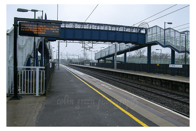
Tile Hill Railway Station is unusual for in that it only features 1 pictures which was snapped quickly when arriving at the station to catch my train to Berkeswell, my train was just arriving. I am unlikely to return living some 100 miles away so will probably never add to it.
Tile Hill serves the suburbs of Coventry, in the West Midlands and is on the main line railway between London Euston and Birmingham New Street Stations. The station opened as Allesley Lane in 1850, before changing names to Allesley Gate in 1857 and finally assuming the name Tile Hill on April 1 1864. Built with staggered platforms either side of the Cromwell Lane level crossing the station remained unchanged until the 1960's when the electrification of the main line resulted in the station being completely rebuilt in its current form. The level crossing was replaced by a bridge in 2004 and the platform connecting bridge was constructed at the same time.
The station has a ticket office which is open at various times 7 days a week, there are 2 trains per hour in the directions of Birmingham and London. The station has always been a busy station averaging approx 700,000 passengers per year until a combination of developments of the car parking and the current Covid 19 virus situation saw number drop to just 107,000 during the most recent period 2020-21, an average reduction of approx 11,000 passengers per week.
The picture was taken using a Nikon d3300 SLR on January 18 2017.
Clicking the image will open a link in another window to the higher resolution, un-watermarked version of the picture on Clickasnap.
Thanks for looking, please take a moment to share and follow me on social media.
Slaithwaite Railway Station is a village stop 4 miles west of Huddersfield towards Manchester. Opened in December 1982 to replace a earlier station.
The original station was a larger complex, consisting of 4 platforms all with canopies and waiting areas, and all in alignment with each other, and it also had a large goods area, the modern day Manchester bound trains platform is now sighted here. It remained a popular busy station until closure in October 1968, despite campaigns to keep it open, these continued after closure and site clearance until the early 1980's when Metro (West Yorkshire Passenger Transport Executive) revealed plans to re-open the station.
The new station features 2 platforms staggered either side of Crimble Bank Bridge. There are limited facilities, only basic cover, no toilets or refreshments and the station is unmanned. Step free access to both platforms is available. Passenger numbers in 2018/19 were 208000 per year at an average of approx. 4000 per week.
These pictures were taken on the 25th July 2020 using a Nikon d3300 SLR camera. There are a total of 15 which can be seen here, on Flickr and Clickasnap.
Crimble Bank Bridge, the station's platforms are staggered either side of the structure. Platform 2 is accessed by the road to the left, Platform 2 on the other side of the bridge.
The steps can be seen opposite the entrance to platform 1 at the station. The lead up to housing on Bank Top.
The station entrance to the Manchester bound platform 2. The cobbled road used to lead up to the goods yard.
Train passing platform 1 for Huddersfield bound trains. Platform 1 sits upon the site of the original station which featured 4 platforms including a central island one. When the original station closed the line capacity was halved.
Platform 1
Platform 1 pictured from platform 2
Platform 2 occupies a site on the original station goods yard.
This artwork - bench can be found at the entrance to platform 1.
The pictures can be seen on YouTube, please take a moment to subscribe to my channel there.
Thanks for looking and please take a moment to share and follow me on social media.
Clicking any picture should open a link to the un-watermarked version on Clickasnap. The pictures shown were updated on the 1st September 2023.
All the pictures remain the copyright of Colin Green.
Denby Dale Railway Station serves the village of Denby Dale in Kirklees, West Yorkshire, it was opened on the 1st July 1850 as a much larger, grander station featuring a number of buildings and platforms and track in both directions. Much of the Penistone Line was singled north of Stocksmoor Station but the line past Denby Dale had already been reduced, having been singled from Clayton West Junction to Penistone through the station and over the viaduct in 1969, with the north bound platform, buildings and entrance removed, not much is evident they were ever there now.
The station was planned by the Huddersfield and Sheffield Junction Railway who had received permission from parliament to build the line in June 1845, by the time the build was completed and opened the line was owned by the Lancashire and Yorkshire Railway who they had merged with along with many others in July 1847.
The modern day station offers only limited facilities with no toilets or refreshments available, the village centre is only a short walk away though. It is currently used by an average of 3442 passengers per week with an hourly service in each direction Monday to Saturday.
The pictures below, which can also be seen on Clickasnap were taken on the 21st May 2016 with a Nikon d3300 SLR camera.
Denby Dale Viaduct was built along with the line and opened in 1850, originally it was constructed of timber, due to the local price of stone making the project unaffordable. Despite concerns and visit from the board of trade the timber viaduct remained until in March 1877, the railway company under heavy pressure from Huddersfield County Borough Council committed to building a new stone viaduct. Work commenced on the new viaduct adjacent to the timber one in September 1877 and it was opened on the 15th May 1880. The viaduct is now Grade II listed and features 21 arches.
Thanks for looking, please take a moment to share and follow me on social media.
All the pictures remain the copyright of Colin Green.
Kincardine Bridge is a new video I have uploaded to YouTube showing a crossing of the bridge in both directions in November 2019.
The bridge crossers the River Forth approx. 25 miles north west of Edinburgh, and was the nearest road crossing to Scotland's Capital until the Forth Road Bridge opened in 1964. Kincardine Bridge is still the alternative crossing to the Forth Road Bridge and Queensferry Crossing when they are closed or restricted due to accidents or severe weather. The bridge connects the boroughs of Falkirk and Fife.
Built between 1932 and 1936 by designers Sir Alexander Gibb and Architect Donald Watson, the opening having been delayed due to a steam ship crashing into the construction in February 1935. The decision to build the bridge having been made when traffic levels at Stirling Bridge, which then was the nearest point of crossing the Forth other than by ferry had risen from approx. 150 per hour in 1922 to over 400 per hour by 1932. Built with a central section a of 364ft that acted as a swing bridge to allow ships to pass through to the Port of Alloa, this section remaining in use until 1988 and being locked shut in 1989. The mechanics are still there to operate the swing bridge but it is unlikely ever to be used again. The bridge has a total length of 2697ft and cost £327000 to build. Whilst still in use it was replaced as the main bridge crossing in 2008 by the Clackmannanshire Bridge which cost £120 million to complete.
Thanks for looking and please take a moment to share and subscribe to my YouTube channel.
The Halifax Gibbet was a guillotine used for public execution, first used locally in the 13th century, some 500 years before it became more popularly associated with the French Revolution. The first man executed on the gibbet was John of Dalton in 1286, with the last thought to have been John Wilkinson and Anthony Mitchell of Sowerby who met their fate on the 30th April 1650. Between them dates their were 52 confirmed executions although it is widely believed that over 100 took place.
The gibbet was built centrally upon a platform 4ft high and 13ft square. The gibbet stood approx. 15ft high with the blade fastened to a block of wood between 2 lengths of wood. The blade was fixed in to place by a pin which was withdrawn by a cord at the moment of executions. The blade was approx. 10 inch x 8 inch in size and was not sharp, relying on speed and weight part the criminals body with head. The criminals were charged under Gibbet Law.
The Gibbet law required that any thief who was caught stealing or who confessed to stealing cloth, goods, or animals within the boundaries of Sowerbyshire or the Forest of Hardwick, of which Halifax was part to the value of 13 1/2d, with the value assed by 4 constables, would be arrested. The criminal would then be tried by a jury and if convicted, they would then be places in the town stocks for 6 days and then executed on the 7th day on the gibbet. Gibbet Law made no allowances for man or women and it is known that at least 5 women were executed by this method. They were as follows,
July 13th 1588 Wife of Thomas Roberts, Halifax
February 22nd 1603 Wife of Peter Harrison, Bradford
November 23rd 1623 George Fairbank & his illegitimate daughter Anna
July 5th 1627 Wife of John Wilson, Northowram
December 8th 1627 Sarah Lum, Halifax
The Gibbet Law allowed for an accused to escape the blade, it said that if the accused was able to with draw his head after the pin was released, and escape across the Hebble Brook, the then boundary approx. 500 yards from the gibbet, then they would be free. 2 men are said to have escaped the blades justice, a Mr Dinnis, and more well known John Lacey also known as the Running Man. In 1617 he escaped the gibbet by running beyond the boundary defined as the Forest of Hardwick or Sowerbyshire after the blades release. Unfortunately for him whilst Gibbet Law allowed for you to escape the punishment, provided you never returned to the boundaries prescribed in the law. He returned to Halifax a few years later, was captured and executed on the 29th January 1623.
The gibbet was outlawed by Oliver Cromwell in 1650, the last 2 victims of it's harsh justice, Mr Anthony Mitchell who was convicted of stealing 16 yards of cloth, valued at 9 shillings, and a Mr Abraham Wilkinson who was convicted of stealing 2 horses, one valued at 9 shillings and the other 48 shillings. They were executed on the same day April 30th 1650.
The site was lost to time, hidden beneath rubbish and soil until a Mr Bates bought the land in 1839 to build a warehouse. In June that year workmen discovered the bodies and heads of 2 people, thought to be Mitchell and Wilkinson and further excavation revealed the gibbet platform. This was eventually restored and in August 1974 a 15ft high replica of the gibbet was constructed upon the platform to highlight it's grisly past. The original gibbet blade is still in existence, having thought to have been lost it was discovered in 1970 at a solicitor's office in Wakefield, it can now be seen at the Bankfield Museum, Halifax.
The pictures shown here today were taken on the 23rd August 2014 using a Polaroid is2132 bridge camera, they can be seen here and on Clickasnap.
Thanks for looking, please take a moment to share and follow me on social media.
Clicking any image should open a link in another window to a higher resolution, un-watermarked version of the image on Clickasnap.
All the pictures remain the copyright of Colin Green.
Crow Wood Park, Sowerby Bridge is a public park built on the site of the former Crow Wood Mansion. Situated at Upper Bolton Brow the park is approx. 5.49 hectares in size and features a skate board area in the former bandstand, bowling green, gardens, tennis courts and children's play area. The park was renamed on the 4th August 2014 to Crow Wood Centenary Park to mark 100 years since the start of the first World War.
The park was originally the site of Crow Wood Mansion and during the World War 1, it was used as a hospital which was closed on the 5th March 1920. In May 1919 the then Sowerby Bridge Council recommended the purchase of the house and estate for use as a public park, maternity home and child welfare centre. The house stood near what are the modern day tennis courts and gardens and was demolished prior to the opening of Crow Wood Park in April 1923. The Memorial gate was unveiled at the park on the 10th November 1929 to remember those who died during the Great War, and now commemorates all the dead of both world wars who served from the Sowerby Bridge area. The park had a bandstand added in 1930 which gives a good view across all the surrounding park land, this is now a skate board area, not being used for bands as long as I can remember. There was also a paddling pool at the park for some years but this has been removed and is now a car park near the garden area.
The pictures were taken on New Years Day 2020 with a Nikon d3300, clicking any image will open a link in another window to the un-watermarked, higher resolution image on Clickasnap.
Thanks for looking, please take a moment to follow and share on social media. Clicking any image should open a link in another window to a higher resolution, un-watermarked version of the image on Clickasnap.
All the images remain the copyright of Colin Green.
Walsden Railway Station serves the village of Walsden, formerly part of Lancashire now firmly in West Yorkshire a couple of miles to the west of Todmorden. The first station here was opened in 1845 and remained in use until post war economy measures it closed in August 1961 along with many other stations and was demolished soon afterwards. All that remains of this station is the metal footbridge built in 1890 and now providing a connection between the platforms, the original station was also sighted to the west of the footbridge running to the entrance to Winterbutlee Tunnel.
The station used to have a level crossing which has been the scene of a few injuries and deaths, this was removed and the current station was built upon the site of the crossing. It is has a stream running underneath the station close to the iron bridge which regularly causes the station and line to be flooded during heavy rains. It was also the only place in the greater Todmorden area to be bombed during the 2nd World War.
The current station opened in September 1990 a few metres east of the original station site, and averages approx. 2100 passengers per week (2017-18 figures). There are limited facilities at the station with only small shelters to provide protection from the weather. There are electronic information boards and ticket machines, the station unstaffed.
To the west of the station stands the 279 metre Winterbutlee Tunnel, opened by the Manchester & Leeds railway Company in 1841 when the line between Todmorden and Littleborough was completed.
The pictures were taken on the 27th August 2017 with a Nikon d3300 camera, they can be seen below and on ClickAsnap un-watermarked.
Manchester direction, the bridge is all that remains of the original station, it was built in 1890. Winterbuttlee Tunnel can be seen beyond.
Winterbuttlee Tunnel from the 1890 Bridge. The original Walsden Station was sighted near the tunnels entrance.
The 1890 metal footbridge is all that remains of the original station at Walsden. There used to be a level crossing where the gate is.
British Rail Class 144 Pacer train at the Leeds bound platform 2.
The steps up and over the 1890 bridge.
Thanks for looking, please take a moment to share and follow me on social media. clicking any image will open a link in another window to the un-watermarked version on Clickasnap.
All the pictures remain the copyright of Colin Green.