Showing posts with label Mountain. Show all posts

Sunday, 13 September 2020

Sgurr Nan Gillean and the Cuillin Hills, Isle of Skye.

Just a short post featuring a picture that forms part of a collection of images I am currently digitising, this shows the peak of Sgurr nan Gillean in the Cuillin Hills on the Isle of Skye, Scotland. Sgurr nan Gillean rises 3169ft above sea level and is stunning triangular profile can be viewed for miles around the hills. The reflections on the front of the image is of Loch Sligachan.

Thanks for looking and please take a moment to share and follow me on social media.

Clicking the image will open a link in another window to my vintage images album on Clickasnap.

Wednesday, 1 July 2020

North Yorkshire Vintage

A collection of pictures taken in North Yorkshire in 1975 - 1976. These are part of a set of 35mm slides I am currently digitising.

The first 3 pictures were taken at Fountains Abbey in September 1975. Fountains Abbey is a ruined Cistercian Monastery that operated from 1132 until it's dissolution under Henry VIII in 1539. They can be found a few short miles south-west of Ripon, North Yorkshire.

Fountains Abbey

Fountain Abbey

Fountain Abbey

The following 2 pictures were taken around the small hamlet of Booze, North Yorkshire in August 1976. The area was built around farming and mining, with Chert, lead and slate all mined close by. Booze was devastated by a mining disaster in the late 18th century when 24 men and 2 ponies were drowned when they blasted in to an underground lake, 18 of the men were from Booze.

Booze, North Yorkshire Old Mines

Harebells Booze North Yorks 1976

The final couple of pictures were taken in Langthwaite, North Yorkshire.  It is one the most northerly settlements of the Yorkshire Dales National Park and is unusual in the area to have so many dwellings close together. These were taken in August 1976.

Langthwaite Village

Hills above Langthwaite

The final picture was taken in a garden at Grassington and shows a Amaryllis Plat in flower.

Amaryllis Plant at Grassington, June 1977,

Thanks for looking and please take a moment to share. Clicking any image should open a link in another window to my Clickasnap vintage images album.

Saturday, 12 October 2019

McInroy's Point, Gourock to Portavadie, Scotland

This set of pictures was taken in December 2015 whilst taking a delivery to Portavadie, Argyll & Bute, Scotland. At the time I was taking a delivery of Doors to a redevelopment near Portavadie Marina and realising I would probably never be in this area again snapped a number of pictures.

The journey started at the ferry terminal McInroy's Point, Gourock on the southern shore of the Firth of Forth and once across the Forth took in a number of A and B roads until I reached Portavadie on Scotland's west coast a distance of over 30 miles. The journey is one of outstanding views and passes through a number of small settlements as well as Tarsan Dam, Kylies of Bute, Holy Loch, Riddon Loch and Striven Loch.

The pictures were taken on the 15th December 2014 using a Polaroid is2132 bridge camera.

The clip features all the images in a slide show video. The images below are a selection of the ones pictured on Flickr and Clickasnap that were taken on the journey. The rest can be seen on the Flickr album or video above.

The pictures below were recently re-edited for Clickasnap, they are a small selection of the 80+ I took whilst driving the route. Clicking any of them should open a link in another window to the un-watermarked version on Clickasnap.


McInroy's Point.


Gourock - Dunoon ferry.


Ardnadam Pier.


Tarsan Dam.


Loch Striven.


The previous 3 images are of the Kyles of Bute.


Thanks for looking, please take a moment to share and follow me on social media. Clicking any image should open a link in another window to the Clickasnap version.

All the pictures remain the copyright of Colin Green.

Saturday, 24 February 2018

Lanzarote's Spark: Where a Tablet and a View Ignited a Passion

In the summer of 2013, I found myself on the volcanic shores of Lanzarote, a place that, at the time, held little more than the promise of a sunny getaway. Little did I know, this island, sculpted by fire and time, would ignite a passion within me that I never knew existed: photography.

With a few days to spare and a desire to explore beyond the resort, I embarked on a comprehensive island tour. It was a decision that would forever alter my perspective. From the surreal, Martian landscapes of Timanfaya National Park, where the earth still breathes with volcanic heat, to the mesmerizing emerald hues of the Green Lagoon, each stop was a revelation. Jameos del Agua, a subterranean wonderland crafted by César Manrique, offered a glimpse into the harmonious blend of nature and art.

But it was El Mirador de Guinate, perched on the northernmost tip of the island, that truly captivated me. Standing there, overlooking the narrow strait of El Rio, with the serene island of La Graciosa floating in the distance, I felt a profound sense of awe. The landscape was a symphony of blues and browns, a panorama that stretched beyond the horizon.

Nestled within the municipality of Haria, El Mirador de Guinate is more than just a viewpoint. It’s an experience. The surrounding tropical park, a lush oasis against the stark volcanic backdrop, teems with diverse flora and fauna. As I wandered through its winding paths, I encountered vibrant birds, exotic plants, and the tranquil atmosphere that permeated the entire area.

Armed with nothing more than my trusty Samsung Galaxy Tablet, I began to capture these moments. It wasn’t a deliberate act of artistic expression at first; it was simply an attempt to hold onto the beauty I was witnessing. Yet, as I reviewed the images on the tablet’s screen, something shifted within me. I saw the world in a new light, framed and composed, captured in time.

The date was July 30th, 2013. A seemingly ordinary day, but one that marked the beginning of my photographic journey. The simplicity of my tablet, a tool I had previously used for casual browsing and entertainment, became the catalyst for a newfound passion. It was a reminder that inspiration can strike in the most unexpected places and with the most unassuming tools.

Looking back, those images, are more than just snapshots. They are a testament to the transformative power of travel, the unexpected beauty of Lanzarote, and the serendipitous discovery of a creative outlet. They are a reminder that sometimes, all it takes is a stunning view and a simple device to ignite a spark within.

Lanzarote, with its unique landscapes and captivating vistas, offered me more than just a holiday. It offered me a new way of seeing the world, a perspective that continues to shape my creative endeavours to this day. It was a lesson in appreciating the beauty that surrounds us and the potential that lies within the most unexpected moments. And it all started with a tablet and a view from El Mirador de Guinate.

Clicking any of the images should open a link in another window to my Colin Green Photography store on Zazzle.

Caleta del Sebo, the largest settlement on La Graciosa with a population
of over 730. The islands only ferry service runs from here connecting
with Orzola, Lanzarote.

The looking down towards the waters edge is approx 500 feet
from where the picture was taken. 

The western tip of La Graciosa.


Thanks for looking and please take a moment to share and follow me on social media, and check out my portfolio on Photo4Me via the link below.


All the pictures remain the copyright of Colin Green.

Saturday, 20 January 2018

Whispers of Wind and Stone: Stoodley Pike (October 2013)

Imagine standing atop a windswept hill, the vast expanse of the Calder Valley stretching out before you like a rumpled green carpet. The air is crisp, the silence broken only by the rustling of heather and the distant bleating of sheep. This isn't just any hill; it's Stoodley Pike, a sentinel of the South Pennines, and its crown jewel is the imposing monument that pierces the skyline, a testament to history and resilience.

Stoodley Pike, rising approximately 1300 feet (400 meters) above the villages of Mankinholes and Lumbutts, isn't merely a geographical feature. It's a living chronicle, a place where time folds in on itself. The monument, visible for miles, whispers tales of Napoleonic battles and Crimean conflicts.

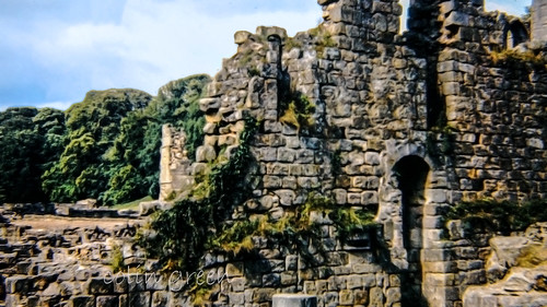
But let's rewind a bit. This isn't the first monument to grace this lofty perch. The original, erected in 1815 to celebrate the defeat of Napoleon, succumbed to the harsh Pennine weather and a dramatic lightning strike. It’s even speculated that a monument was present before this. The replacement, designed by James Green and completed in 1856 as the Crimean War ended, stands further from the edge, a lesson learned from its predecessor’s demise.

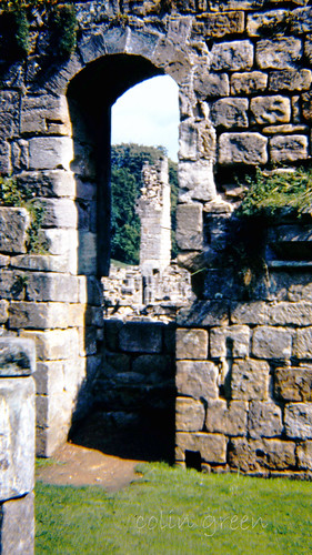
And what a replacement it is! A formidable stone structure, it houses a spiral staircase that ascends to a balcony, offering panoramic views that will steal your breath away. The climb, however, is not for the faint of heart. 39 steps plunge into near-total darkness, a stark contrast to the brilliant landscape outside. A torch is an absolute must – the "light-enhancing" grill is, as I've found, more of a decorative feature.

As you stand at the entrance, facing north, a faded inscription etched in stone tells a story of war, peace, and strange coincidences:

STOODLEY PIKEA

BEACON MONUMENT

ERECTED BY PUBLIC SUBSCRIPTION

COMMENCED IN 1814 TO COMMEMORATE

THE SURRENDER OF PARIS TO THE ALLIES

AND FINISHED AFTER THE BATTLE OF

WATERLOO WHEN PEACE WAS ESTABLISHED IN 1815.

BY A STRANGE COINCIDENCE

THE PIKE FELL ON THE DAY THE RUSSIAN

AMBASSADOR LEFT LONDON BEFORE THE

DECLARATION OF WAR WITH RUSSIA IN 1854.

WAS REBUILT WHEN PEACE WAS RESTORED IN1856.

RESTORED AND LIGHTNING CONDUCTOR FIXED IN1889.

This inscription is more than just words; it's a tangible link to the past, a reminder of the turbulent times that shaped our world. The fact that the original monument fell on the eve of the Crimean War is a chilling example of history's uncanny echoes.

Despite its exposed position and frequent lightning strikes, the monument stands strong, a testament to the skill of its builders and the addition of a lightning conductor in 1889. It's a symbol of enduring strength, a beacon in the wild landscape.

My own visit, captured in the photos taken with a Samsung Galaxy Tablet on October 19th, 2013, only scratched the surface of Stoodley Pike's allure. This isn't just a place to visit; it’s a place to experience, to feel the wind whip around you and to imagine the countless generations who have stood on this very spot, gazing out at the same breath taking view.

So, if you find yourself in West Yorkshire, take the time to explore Stoodley Pike. Climb the dark staircase, read the faded inscription, and let the whispers of wind and stone transport you to a different time. You won't just see the Calder Valley; you'll feel its history, its resilience, and its enduring beauty.

Clicking any of the images below should open a link in another window to my Colin Green Photography store on Zazzle.


Thanks for looking, please take a moment to share and follow me on social media, and check out my portfolio on Photo4Me via the link below.


All the pictures remain the copyright of Colin Green.

Saturday, 8 April 2017

Peñas del Cache: Lanzarote's Majestic Summit

Peñas del Cache, reaching a height of 672 meters above sea level, offers the highest panoramic views on the island of Lanzarote. This popular destination attracts both stargazers, drawn to the clear, dark skies, and sightseers eager to witness the breathtaking vistas stretching across the island and the vast Atlantic Ocean. The name "Peñas del Cache" is believed to originate from the Guanche language, the language of Lanzarote's original inhabitants, and is thought to mean simply "the height."

While a military observation post slightly higher than the public viewing area overlooks Peñas del Cache, access to this post is restricted. The readily accessible viewing point is located in the northern part of the island, within the municipality of Haría.

Geologically, Peñas del Cache is a stratovolcano, a formation built up over millennia by layers of hardened lava and tephra (volcanic ash). Scientists estimate its formation occurred during the Miocene period, which spanned approximately 5 to 23 million years ago. Adding to the area's rich history, archaeological evidence of the Majos, the ancient inhabitants of Lanzarote, has been discovered near Peñas del Cache, offering a glimpse into the island's past.

 
These pictures were taken in July 2013 with my Samsung Galaxy tablet. Clicking any picture below should open a link in another window to my Colin Green Photography Zazzle store.
The Atlantic ocean which surrounds Lanzarote can be seen down at
sea level.


Here is a short film set to music from my YouTube channel taken form the view point.


Please take a moment to share and follow me on social media and view my portfolio on Photo4Me via the link below.


Through a Glass, Darkly: Hebden Bridge Railway Station in Negative

 There's something hauntingly beautiful about old photographs, especially when they're presented in a way that flips our perception....