Showing posts with label Ryburn Valley. Show all posts

Saturday, 24 September 2022

Baitings Reservoir Now Very Low 24 September 2022

Baitings Dam is a reservoir built to supply Wakefield with fresh water, completed in 1956 it is the higher of the 2 dams that block the flow of the River Ryburn here, the lower being Ryburn Dam. Construction cost around £1.4 million and took 8 years to complete, it involved flooding a small hamlet known as Baitings and sub merging the old packhorse bridge that provided a road link between Lancashire and Yorkshire, the bridge still stands and is revealed every time the water level is low. The bridge was replaced by a concrete structure called Back O'th Heights Bridge which gives a good indication of how high the dame is when full by the time marks just underneath the road level. When full the dam can hold over 113,000,000 cubic feet of water, or approx. 703,858,407 gallons.

Baitings is fed by runs offs from the local moorland and is the start of the River Ryburn that flows down the valley eventually reaching the River Calder at Sowerby Bridge approx 6 miles down the valley. It also flows in to the Ryburn Dam a little lower down the valley and built in 1933, also to supply water to Wakefield.

The dam must be somewhere near a historically low level now, the bridge completely uncovered and recently a sluice gate has appeared. I am assuming this was to regulate the flow in to the Ryburn Dam prior to Baitings being built. There was a footpath bridge between this sluice gate and the dam head but the water hasn't got low enough yet to reveal wether this is still there. Maybe a couple more weeks of low rainfall and it might appear if still there.

These pictures were taken on the 24th September 2022 using a Nikon d330 SLR camera, they can be seen below and on Clickasnap full size, resolution and un-watermarked.


The packhorse bridge appearing from beneath the water has gone from a once in decade or so event to every couple of years.

Whilst it's likely that levels have been low enough before for the original dam and sluice gate to appear, this was the first time I had seen them.


The original packhorse bridge, often submerged seen through the legs of it's modern replacement.


Thanks for looking and please take a moment to share and follow me on social media.

Clicking any image will open a link in another window to the version on Clickasnap.

All the images remain the copyright of Colin Green.

Saturday, 4 December 2021

The Rishworth Branch Line December 2013

 One of my favourite places to explore with my camera is the remains of the Rishworth Branch Line, a railway that connected the Ryburn Valley with the mainline at Sowerby Bridge. The line had stations and halts at Rishworth, Ripponden, Triangle and Watson's Crossing. Much of the line remains in tact with a number of Bridges still providing crossings over the former trackbed. The Scar Head Tunnel is still running underneath the Norland Hillside although inaccessible for people wanting to look inside, and the platform at Rishworth still remains although now covered by vegetation. The former pedestrian bridge, Ripponden Bank road bridge and wooden trellis bridge that connected Rishworth Station with the turnpike have all been removed since the line closed in addition to all the station buildings.

The Rishworth Branch line was opened as the first stage of a much bigger scheme to shorten the railway connection between Sowerby Bridge and Littleborough by approx 5 miles by tunnelling underneath the Pennines separating Lancashire and Yorkshire. This plan was abandoned when the company responsible ran in to a number of difficulties in completing the line to Rishworth.

The Lancashire and Yorkshire Railway line along the Ryburn Valley was authorised in 1865 and the line to Ripponden completed in 1878. This was extended to Rishworth in 1881 with stations opening there and in Triangle the same year. Upon completion the line was built to double track but for much of it's life only utilised one line with the 2nd track being used to store carriages.

At the turn of the 20th century motor railcars were introduced along the line and this led to a new halt opening at Watson's Crossing in 1907, this was probably the height of the lines usage as growing competition from trams and motor cars led to a decline in passenger numbers and this service was withdrawn on the 8th July 1929 with only goods traffic continuing. The line between Ripponden and Rishworth was closed in March 1952 due to engineering issues and completely on the 1st September 1958. Much of the former trackbed is now accessible for walkers, although some stretchers are in private ownership.

The pictures were taken on the 7th December 2013 with a Samsung Galaxy Tablet.

These first set of pictures were taken on the stretch of line from Scar Head Tunnel to the site of Triangle Station.

Scar Head Tunnel Portal


The former site of Triangle Station

The next selection of pictures were taken on the lines remains between Triangle Station and Ripponden Station.


The former Ripponden station used to sit at the top of the abutment.

The following pictures were taken on the line between the site of Ripponden Station and the Rishworth terminus. This section was the last to open in 1881 and also the first to fully close in 1953.

The former trackbed through this section was so wet on the day I was there it resembled a canal rather than the former trackbed of a railway.


The former Rishworth station platform still remained, although largely reclaimed by nature, when I visited it had been 60 years since it had seen a train and 84 since a passenger had waited on it stone concourse.

This was the entrance to Rishworth Station which was reached by a wooden trestle bridge, which constantly had issued regarding stability. The bridge was strengthened in the 1920's and was one of the reasons that led to the closure of Rishworth station in 1953 some 5 years before the rest of the line, when the bridge was demolished.

Thanks for looking and please take a moment to share and follow me on social media.

Clicking any image should open a link in another window to the un-watermarked, higher resolution version on Clickasnap.

All the pictures remain the copyright of Colin Green.

Saturday, 18 August 2018

Tracing the Ghost Tracks: A Walk Along the Rishworth Branch Line

The Ryburn Valley, a picturesque slice of West Yorkshire, holds secrets whispered on the winter wind. On a crisp January day in 2016, armed with my Nikon D3300, I set out to explore a fragment of its forgotten past: the Rishworth Branch Line. This railway, a vital artery in its time, once snaked its way up the valley from Sowerby Bridge, connecting Watson's Mill Crossing, Triangle, and Ripponden before reaching its final destination in Rishworth.

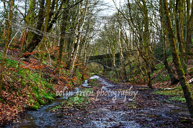
Though the last train rattled along these tracks in the 1950s, the remnants of this once-bustling line remain, etched into the landscape. My journey, a roughly half-mile trek, took me from the echoes of Watson's Mill to the quiet village of Triangle. And what a journey it was!

The air was sharp and cold, the ground firm underfoot, as I followed the ghostly path of the former trackbed. The silence was profound, broken only by the occasional rustle of winter-bare trees and the distant murmur of the Ryburn River. It was easy to imagine the steam engines, their rhythmic chugging echoing through the valley, the shouts of passengers and the clatter of cargo.

What struck me most were the bridges. These sturdy stone structures, silent witnesses to a bygone era, still spanned the former trackbed, their arches framing snippets of the valley's beauty. They stood as testaments to the engineering prowess of the past, their weathered stones bearing the marks of time and the elements.

The photographs I captured on that day, the 30th of January 2016, tell a story of quiet resilience. The stark beauty of the winter landscape, the skeletal trees against the pale sky, the weathered stones of the bridges – all combined to create a sense of timelessness.

Walking along the Rishworth Branch Line was like stepping into a historical photograph. It was a journey through time, a glimpse into a world where steam engines ruled the rails and communities were connected by the iron horse.

It's a reminder that even when progress moves forward, the echoes of the past remain, woven into the fabric of the landscape. The Rishworth Branch Line, though silent, continues to tell its story, a story of connection, community, and the enduring beauty of the Ryburn Valley. If you ever find yourself in the area, take a walk along these ghost tracks. You might just hear the whispers of history on the winter wind.

Clicking any of the images below should open a window to my Colin Green Photography store on Zazzle.


Thanks for looking, please take a moment to share and follow me on social media, and check out my portfolio's on Photo4Me and Clickasnap via the links below.


All the images remain the copyright of Colin Green.

Sunday, 20 August 2017

A Journey Through Time: Exploring the Lost Rishworth Branch Line

The Ryburn Valley, a picturesque stretch of West Yorkshire, whispers tales of a bygone era, a time when the rhythmic chug of steam trains echoed through its hills. This is the story of the Rishworth Branch Line, a railway that briefly connected the valley to the wider world, leaving behind a legacy of intriguing remnants for the modern explorer.

Conceived in the ambitious railway boom of the mid-19th century, the Rishworth Branch Line was initially proposed in 1865. However, it wasn't until 1873 that construction finally began. The first section, stretching from Sowerby Bridge to Ripponden, opened its doors to passengers in 1878, a testament to the Victorian engineering prowess of the time. The line was finally completed to Rishworth in 1881, promising to bring prosperity and connectivity to this rural community.

The initial vision for the line was far grander. Ambitious plans included tunnelling through the imposing moorland to connect with the main line at Rochdale. This would have created a significant through route. However, the challenging terrain and persistent problems with landslides and other geological issues meant this ambitious connection never materialized. The Rishworth Branch Line remained a quiet branch, nestled within the Ryburn Valley.

Despite its relatively short lifespan, the line played a vital role in the local economy, transporting goods and passengers and connecting communities. However, the same challenges that plagued its construction ultimately contributed to its demise. Problems with the surrounding land, likely including landslips and subsidence, led to the closure of the section between Ripponden and Rishworth in March 1952. The final nail in the coffin came in September 1958, when the entire line was closed, marking the end of an era for the Ryburn Valley.

Today, the Rishworth Branch Line exists largely in memory, a ghost of its former self. Yet, for those willing to seek them out, remnants of this railway adventure remain. Several of the sturdy bridge crossings still span the valley, silent witnesses to the trains that once thundered across them. The most impressive relic is perhaps the Scar Head Tunnel, a dark and mysterious portal into the past.

And at Rishworth, the station platform still stands, a poignant reminder of the bustling hub it once was. Though now largely hidden by encroaching undergrowth and inaccessible due to being on private land, the platform waits patiently, a silent sentinel dreaming of the trains that will never arrive. It's a powerful image, a testament to the fleeting nature of progress and the enduring charm of forgotten railways.

The Rishworth Branch Line may be gone, but its story continues to fascinate. It's a story of ambition, engineering challenges, and the changing landscape of transportation. It's a story etched into the very fabric of the Ryburn Valley, waiting to be rediscovered by those who dare to look. So, next time you find yourself in the area, take a moment to imagine the sights and sounds of the Rishworth Branch Line, a lost railway that still whispers its secrets to the wind.

The majority of these pictures featured in this slideshow were taken using my Nikon D3300 camera on April 29, 2016.


Thanks for looking and taking a moment to share. Like and follow me if you enjoy my posts using the buttons to the left, or if on Clickasnap or YouTube

Thursday, 8 June 2017

Wainhouse Tower: A Monument to Spite (and Stunning Views)

Standing proud atop King Cross, overlooking Halifax, West Yorkshire, Wainhouse Tower isn't your average landmark. This magnificent folly, soaring to a dizzying 275 feet, holds the title of the tallest folly in the world. A climb of 403 steps to the lower viewing area rewards visitors with breathtaking panoramic views across the Calder Valley – a vista well worth the small entrance fee charged on bank holidays.

But Wainhouse Tower's story is far more intriguing than just its impressive height. Originally conceived as a chimney for the Washer Lane Dye Works, the tower's fate took a dramatic turn when the works manager, upon purchasing the business, balked at the cost of the towering chimney. Enter John Edward Wainhouse, a man with a vision… and perhaps a touch of spite.

Legend has it that Wainhouse harbored a long-standing feud with his neighbor, Sir Henry Edwards, whose estate was renowned for its privacy. Wainhouse, determined to ensure Edwards could never again claim such seclusion, transformed the unfinished chimney into a magnificent viewing tower. And so, the tale of the "Tower of Spite" was born. Whether fuelled by genuine animosity or simply a touch of playful rivalry, Wainhouse poured £14,000 into the project (equivalent to over £1.1 million today!), completing it in 1875.

While the "Tower of Spite" story adds a colourful layer to its history, Wainhouse Tower has served a more practical purpose over the years. It came under the ownership of Halifax Corporation in 1919, served as an observation post during World War II, and finally became the property of Calderdale Council in 1974. Today, it stands as a testament to Victorian ingenuity, a quirky reminder of local rivalries, and, most importantly, a fantastic vantage point for appreciating the beauty of the Calder Valley. So, if you're ever in Halifax on a bank holiday, be sure to make the climb – the views (and the story) are truly unforgettable.

These pictures were taken on various dates during the year 2016. They were taken using a Nikon d3300 SLR camera. Clicking any image should open a link in another window to my Colin Green Photography store on Clickasnap.


The tower pictured from Albert Prom, or The Rocks as it's known locally.


The large building to the front is Halifax Bank's Copley Data Centre, built in the 1980s. The data centre is due to close in the next few years.

 Thanks for looking; please take a moment to share and follow me on social media and check out my portfolio on Photo4Me via the link below.


All the pictures remain the copyright of Colin Green.

Through a Glass, Darkly: Hebden Bridge Railway Station in Negative

 There's something hauntingly beautiful about old photographs, especially when they're presented in a way that flips our perception....