Showing posts with label Snow. Show all posts

Wednesday, 29 May 2024

A Walk in Winter: The Calder and Hebble Navigation

These black and white photos capture the stark beauty of a winter scene along the Calder and Hebble Navigation. The path, blanketed in snow, winds its way alongside a still waterway. The trees lining the bank are bare, their branches reaching out like skeletal fingers towards the inky sky.

The absence of color in this photo only heightens the sense of tranquility. The world seems hushed, blanketed in a peaceful silence. Footprints visible in the snow are likely those of lonely hikers, making the viewer feel as though they are a remote person in this isolated landscape.

The Calder and Hebble Navigation is a 21-mile canal in West Yorkshire, England. It was built in the late 18th century to connect Sowerby Bridge with Wakefield. Today, the canal is a popular spot for walking, cycling, and boating.

This photo is a reminder that even in the depths of winter, there is beauty to be found in the natural world. The stark contrast of the black and white tones highlights the simple elegance of the scene. The stillness of the river and the bare branches of the trees create a sense of peace and tranquility.

If you're looking for a place to escape the hustle and bustle of everyday life, the Calder and Hebble Navigation is a great option. A walk along the canal towpath is a chance to connect with nature and appreciate the beauty of the season, whatever the weather.

In addition to its natural beauty, the Calder and Hebble Navigation is also steeped in history. The canal was an important transportation artery during the Industrial Revolution, and there are a number of old mills and warehouses along its banks. Today, these buildings have been converted into homes, businesses, and arts centers.

Whether you're interested in history, nature, or simply looking for a place to relax, the Calder and Hebble Navigation is a great place to visit. So next time you're in West Yorkshire, be sure to take a walk along this historic waterway. You might just be surprised by the beauty you find.

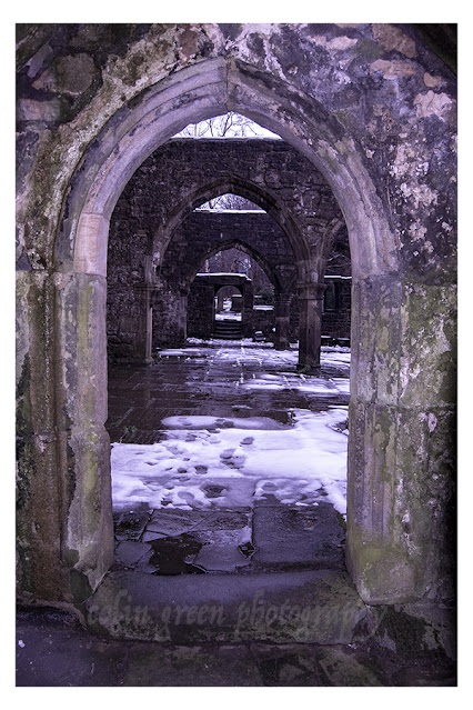
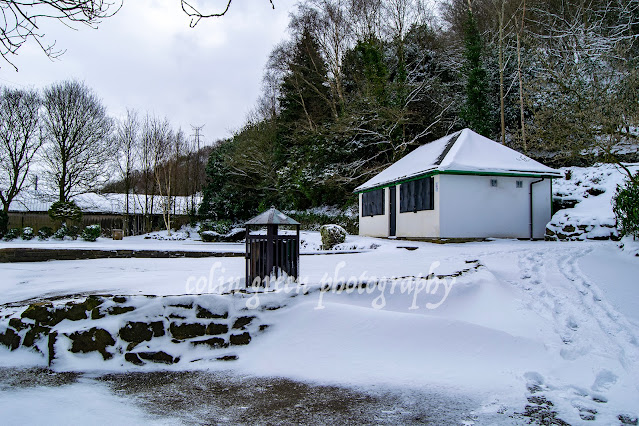
The pictures below were taken on the 17th January 2016 with a Nikon D3300 Camera, they can also be seen in a higher resolution on Clickasnap, by simply clicking any of the images. All will open in another window.

The canal pictured looking away from Walker Lane Bridge towards Chain Bridge. The Sowerby Bridge Gas Works and Gasometers used to occupy a site to the left of the picture just beyond the trees, the gasometers have long since been removed.

The canal is pictured here between Hollas Lane Bridge (Sterne Mills Bridge) and Edwards Road Bridge (Canal Mills Bridge). Both Bridges tend to known by either name, the land to the left of the picture has been redeveloped in to Copley Valley a mixed use zone of housing, industry and nature areas since this picture was taken. The land to the right of the picture may also face redevelopment in the coming years, it was for a number of years a car park for the Halifax Bank's Copley Data Centre, this has been closed for a while now with the data set to close and be sold off in the near future.

The canal towards Mearclough Canal Bridge, the waterway narrows a little here, often wondered why.

Clicking any image should open a link to the version on Clickasnap. Various images and products of mine are avaliable to view and purchase from the sites below, clicking any link will open in another window.

All the images remain the copyright of Colin Green.


The following images are the colour versions of the pictures,


Sunday, 28 January 2024

Stoodley Pike November 2016

Towering over the Calder Valley, Stoodley Pike is more than just a hill overlooking the town of Todmorden, West Yorkshire; it's a monument; it's a beacon, a challenge, and a gateway to breathtaking panoramas. I embarked on my own Stoodley Pike adventure, and let me tell you, it was an experience in stunning vistas.

There are several routes to the summit, each offering its own unique charm. I opted for the Shaw Wood Road trail, starting from the A646 Burnley Road. The trail leaves Burnley Road almost immediately, crossing over the Rochdale Canal alongside Lock No. 15 Shawplains. The road winds through woodlands before reaching a housing estate at Lee Bottom Road, which runs eastward, offering glimpses of the imposing Pike as you ascend. Be prepared for a good workout, as the trail steadily gains elevation.

Finally, after conquering the final incline, the reward arrives. The 39-step spiral staircase beckons, leading you up another 40 feet to the balcony of the monument. Remember, a torch is recommended, as the narrow passage plunges into darkness, despite a grill that is meant to offer a light source.

The views from the top are nothing short of magnificent. The hill, at a height of 1300 feet, shows rolling fields in every direction, dotted with villages, reservoirs, and the distant Pennine peaks. On a clear day, you can even see Manchester and the Irish Sea! Take a deep breath, soak it all in, and feel the sense of accomplishment wash over you.

But Stoodley Pike is more than just a scenic overlook. It's steeped in history, dating back to the Iron Age. Explore the monument's intriguing inscriptions and weathered stones, whispering tales of the past. A monument was originally built to commemorate the Napoleonic Wars and then rebuilt to remember the Crimean War.

The monument features the following faded inscription above the north facing door:

STOODLEY PIKE
A BEACON MONUMENT
ERECTED BY PUBLIC SUBSCRIPTION
COMMENCED IN 1814 TO COMMEMORATE
THE SURRENDER OF PARIS TO THE ALLIES
AND FINISHED AFTER THE BATTLE OF
WATERLOO WHEN PEACE WAS ESTABLISHED IN 1815.
BY A STRANGE COINCIDENCE
THE PIKE FELL ON THE DAY THE RUSSIAN
AMBASSADOR LEFT LONDON BEFORE THE
DECLARATION OF WAR WITH RUSSIA IN 1854.
WAS REBUILT WHEN PEACE WAS RESTORED IN
1856.
RESTORED AND LIGHTNING CONDUCTOR FIXED IN
1889.
 
The pictures below were taken on the 19th November 2016 with a Nikon D3300; they can be seen un-watermarked on my Clickasnap portfolio. Click any image to view it there.

The path up to Stoodley Pike, the monument visible at the summit.

I think the snow clinging to the side of the structure gives the monument a completely different feel to its usual look.


The Calder Valley and beyond towards Lancashire, taken from the base of the monument.

Looking west away from the monument, I have always liked this picture as it's gives the impression the clouds will shortly fall over the edge of the hill.

Thanks for looking, please take a moment to share and follow me on social media, you can also check out my Zazzle stores and Photo4Me portfolio via the links below.


All the pictures remain the copyright of Colin Green.

Thursday, 30 December 2021

The Ruins of the Church of St Thomas a' Becket

 Built sometime in late 12th - early 13th Century, the Heptonstall Parish Church was known as the Church of St Thomas a' Becket. It was also known as the chapel The Chapel of St Thomas the Martyr. It was built to serve the communities of Heptonstall, Erringden, Langfield, Stansfield and Wadsworth. The Priests were appointed and paid for by the Vicar of Halifax as the church was to serve the people to the west of Halifax.

The church was closed for a time around the turn of the 16th Century due to the murder of a priest, it was said he had performed an illicit marriage ceremony. The church underwent renovations in the 14th, 15th, 16th and 17th centuries, and a new clock was installed in 1810. This was moved to the new church.

The church was damaged by a storm in 1847 which tore off the roof, damaged the tower and caused considerable damage to the churchyard. The church rate, a tax payable by all parishioners to support the parish church was insufficient to repair the damage. A new church was built in the same churchyard funded by voluntary subscription and this opened in 1854.

The church ruins still stand to this day and occasionally outdoor services are conducted in the remains of the St Thomas a' Becket. I took these pictures on the 19th November 2016 with a Nikon d3300, they can also be seen un-watermarked and higher resolution on Clickasnap. Click any image and a link will open in another window.


Clicking any image will open a ink in another window to the un-watermarked, higher resolution version on Clickasnap.

Thanks for looking and please take a moment to share and follow me on social media.

All the pictures remain the copyright of Colin Green.

Friday, 22 March 2019

Winter at Willow Hall Dam, Sowerby Bridge

I haven't posted for a while despite having loads of pictures and videos available, just been busy job hunting. I think that that problem is now addressed so I thought I would post today about a set of pictures I took a year ago at Willow Hall Dam, Sowerby Bridge. Last years winter seemed to be the  winter that kept on giving and looking back now after a normal UK mild winter I have no nostalgia for how bad the weather was. I know it was only a few inches at worst but in the UK any weather that is deemed out of the ordinary seems to bring the country to a standstill, we as a nation are just obsessed by it.

Willow Hall Dam is actually 2 dams, with the lower used as a fishing lake and the upper mainly feeding it and looking overgrown. I'm not sure what the dam's original purpose was, there were a number of mills nearby which have long since disappeared so I assume it was to help drive power to one of those. The dam is surrounded by woodland on 3 sides and is popular with locals walking there dogs. Dam Head Road runs across the head of the dam and there is terraced housing either side of the dam head. These pictures were taken using a Nikon d3300 SLR camera on the 18th March 2018, they can be seen below or on Clickasnap un-watermarked.


Clicking any image should open a link in another window to the Clickasnap version.

Thanks for looking, please take a moment to share and follow me on social media.

All the pictures remain the copyright of Colin Green.

Saturday, 18 August 2018

Exploring Allan Park, Sowerby Bridge

Nestled on the slopes of the Norland hillside, a stone's throw from Sowerby Bridge Railway Station, lies Allan Park. It's a charming public space, a green oasis carved into the landscape, and a place where history whispers from every level. But this isn't just your average park; it's a story etched in terraces, bowling greens, and the silent passage of forgotten railways.

My visit, captured on a crisp March 18th, 2018, with my trusty Nikon D3300, revealed a park of surprising depth. What strikes you first is the tiered nature of the landscape. Allan Park isn't a flat expanse; it's a series of levels, a testament to the effort it took to tame the hillside. This unique topography lends the park a sense of intimacy and discovery as you wander from one section to the next.

The story behind Allan Park is as intriguing as its layout. It was once the grounds of Allan House, a grand residence purchased by the council in 1922. The original vision was ambitious: a public swimming pool. Imagine the bustling sounds of swimmers echoing through the valley! However, those plans never materialized. Instead, Allan House found a new purpose, transforming into a clinic, serving the community in a different way.

And the grounds? They were reborn as a public park, a space for recreation and relaxation. A bowling green, a playground filled with the laughter of children, and tranquil woodland walking areas emerged, creating a diverse space for all to enjoy. It's a testament to how a space can evolve, adapting to the changing needs of a community.

But perhaps the most fascinating secret lies beneath our feet. Underneath the serene park grounds, the Scar Head Tunnel quietly exists, a relic of the Rishworth Branch Railway Line. Imagine the rumble of steam trains echoing through the hillside, a stark contrast to the peaceful atmosphere of the park today. It's a hidden layer of history, a reminder of the industrial past that shaped this region.

Walking through Allan Park, you can't help but feel a connection to the past. The echoes of Allan House, the dreams of a swimming pool, the forgotten railway line – they all contribute to the park's unique character. It's a place where history and nature intertwine, offering a moment of tranquility amidst the everyday.

The photos I took on that March day capture a snapshot of this hidden gem. The subtle textures of the stonework, the vibrant green of the bowling green, the quiet beauty of the woodland paths – all speak to the park's unassuming charm.

If you find yourself near Sowerby Bridge, take a moment to explore Allan Park. It's more than just a park; it's a journey through time, a glimpse into the past, and a peaceful escape into nature. You might just discover a hidden history of your own.

Clicking any of the pictures below should open a link in another window to my Colin Green Photography store on Zazzle.


Thanks for looking, please take a moment to share and follow me on social media, and check out my portfolio's on Photo4Me and Clickasnap via the links below.


All the pictures remain the copyright of Colin Green.

Saturday, 28 July 2018

A Winter's Whisper: Copley Riverside in a Blanket of Snow

The River Calder, a lifeline through West Yorkshire, paints a different picture with each passing season. But there's a particular magic in its winter guise, a serene beauty that I was fortunate enough to capture on a crisp December day.

On December 29th, 2017, I embarked on a walk along the path that hugs the River Calder near Copley, a charming village nestled in the heart of the region. The day was draped in a fresh layer of snow, the first of the season, if my memory serves me correctly, transforming the familiar landscape into a winter wonderland.

These seven photographs, taken along the riverbank near Copley Cricket Ground, stretching towards the newly opened Wilson Bridge, tell a story of quiet beauty. They offer a glimpse into a world where the river's gentle flow meets the stillness of a snow-covered landscape.

A Winter's Tale in Seven Frames:

  • The Silent River: The Calder, usually a bustling waterway, flowed with a hushed tranquillity, its surface reflecting the soft, grey sky.
  • Snow-Dusted Trees: The bare branches of the riverside trees were delicately outlined in white, creating intricate patterns against the winter backdrop.
  • The Path Less Travelled: The walking path, usually well-trodden, bore only the faint imprints of my own footsteps, a testament to the quiet solitude of the day.
  • Copley Cricket Ground's Winter Rest: The familiar green of the cricket ground was transformed into a pristine expanse of white, a silent witness to the winter's arrival.
  • Wilson Bridge's Debut: The newly constructed Wilson Bridge, replacing the older stone structure, stood as a modern counterpoint to the timeless beauty of the surrounding landscape. The bridge itself was a stark contrast to the natural beauty around it.
  • A Landscape Refreshed: The snow had softened the edges of the landscape, creating a sense of peace and tranquillity.
  • Winter's Light: The soft, diffused light of the winter day bathed the scene in a gentle glow, highlighting the subtle textures of the snow and the river.

The Magic of a Snowy Walk:

There's something uniquely captivating about a winter walk along a riverside. The crisp air, the crunch of snow underfoot, and the quiet beauty of the landscape create a sense of peace and tranquillity. This walk along the Copley Riverside, captured in these seven photographs, was a reminder of the simple beauty that can be found in the heart of winter.

The recent construction of Wilson Bridge, although a needed improvement, does not distract from the natural beauty of the area. It is a testament to the progression of the town, while the river itself remains a constant.

These pictures are a snapshot of a moment in time, a winter's whisper along the River Calder. They serve as a reminder of the beauty that can be found in even the simplest of landscapes, especially when touched by the magic of snow.

Clicking any of the images below should open a link in another window to my Colin Green Photography store on Zazzle.


Thanks for looking, please take a moment to share and follow me on social media, and check out my portfolio's on Photo4Me and ClickAsnap via the links below.


All the pictures remain the copyright of Colin Green.

Through a Glass, Darkly: Hebden Bridge Railway Station in Negative

 There's something hauntingly beautiful about old photographs, especially when they're presented in a way that flips our perception....