Showing posts with label Structure. Show all posts

Saturday, 16 November 2024

North Bridge, Halifax

 A Bridge Through Time

North Bridge, a striking Victorian iron and stone structure, stands as a testament to Halifax's rich industrial past. Spanning the River Hebble, this iconic bridge has played a vital role in connecting the town to the wider region for over a century.

A Bridge Reborn

The original stone bridge, built in 1774, met a tragic end in 1855 due to flash flooding. To accommodate the growing needs of the town and the emerging railway network, a new bridge was constructed in the grand Victorian Gothic style. Designed by the Fraser brothers, North Bridge opened in 1871, a feat of engineering that was both beautiful and functional.

A Busy Thoroughfare

For many years, North Bridge bore the weight of heavy traffic, including tram lines that extended across the bridge. However, the increasing demands of modern transportation led to the construction of the Burdock Way flyover in 1973, relieving the bridge of much of its burden.

A Lasting Legacy

Despite the passage of time, North Bridge continues to be an integral part of Halifax's identity. Its elegant architecture and historical significance make it a popular landmark for both locals and visitors. As we walk across this magnificent structure, we can't help but marvel at the ingenuity and craftsmanship of those who built it.

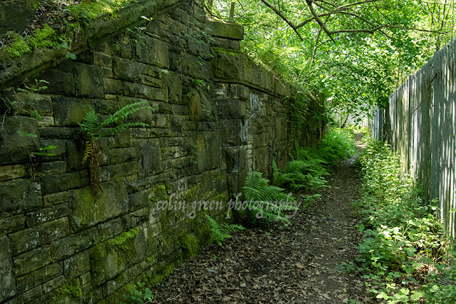
The pictures below were taken with Nikon d3300 on the 3rd July 2022, they can be seen in a higher resolution on my Clickasnap account by clicking any image.


Discover my world of art and photography on Zazzle and photo4Me! Explore my curated collections and find the perfect piece to bring your space to life. From Stunning wall art to unique merchandise, there's something for everyone, and with Zazzle's customisation options, you can personalise your favourite image to match your style and create a truly one of a kind piece.

Click any picture below to open a link to the store you require.


Thanks for looking, all the images remain the copyright of Colin Green.

Discover these stunning images at Colin Green Photography and Calderdale Unframed on Zazzle. Choose from a range of products, including wall art, posters, and photo prints at Colin Green Photography, or postcards, photo blocks, clocks, and mugs at Calderdale Unframed. Customize your shopping experience by adding images to multiple products.

Saturday, 10 February 2024

Hawksclough Bridge, Mytholmroyd

Nestled amidst the rolling hills of the Calder Valley, in the charming Yorkshire village of Mytholmroyd, lies the Grade II listed Hawksclough Bridge. This seemingly unassuming structure, crafted from the warm embrace of local sandstone, is more than just a passage over the River Calder. It's a bridge woven with myth, whispered secrets, and the echoes of a bygone era.

As you stand upon its weathered stones, the gentle gurgle of the water below serenades you, transporting you back in time. Legend has it that the bridge was built by the devil himself, enticed by a wager with a local builder. The deal? The bridge's completion within a night was in exchange for the builder's soul. But as the rooster crowed, signalling the dawn, the bridge remained unfinished, just one stone short. The devil, cheated of his prize, vanished in a puff of brimstone, leaving behind the incomplete bridge as a testament to his trickery.

While the truth behind the bridge's construction is likely less fantastical, the myth adds a touch of magic to its history. It's a reminder that even the most ordinary structures can hold extraordinary stories, waiting to be unraveled by the curious mind.

But Hawksclough Bridge is more than just a relic of the past. It's a vibrant part of the Mytholmroyd community. Children clamber along its edges. Artists capture its rustic beauty in their paintings, and photographers find endless inspiration in its weathered nooks and crannies.

Below are a set of pictures taken at the bridge with a Nikon d3300 in July 2024.


Thanks for looking, please take a moment to share and follow me on social media, check out my stores on Zazzle and portfolio on Photo4Me via the links below.


All the pictures remain the copyright of Colin Green.

Friday, 22 September 2023

Mearclough Bridge and the River Calder

 Mearclough Bridge is a crossing over the River Calder at Sowerby Bridge, West Yorkshire, the current bridge is the latest of a few that have provided a river crossing here connecting the historic townships of Norland and Warley who were separated by the river. Norland town was responsible for keeping the bridge in good repair and were fined for failing in this on the previous bridge, that bridge was replaced by the current crossing between 1774 and the turn of the 19th century.

The current bridge is a 3 arch stone built structure which now has traffic restrictions to prevent HGV crossing it. These preventions were enacted when the new Sterne Mills Bridge was constructed in the mid 2010's, prior to this the only access to the industrial units and recycling centre nearby were via the bridge and it was hit and damaged a number of times by vehicles crossing as the bridge is barely wider than a single track road with no pedestrian pavements. It was given Grade II listed status in 1988 and carries Fall Lane over the River Calder.

From the bridge looking east towards Sowerby Bridge centre is Mearclough Weir which is thought to have once powered Mearclough Mills which is said to have been a Corn Mill around it's construction in the early 1800's.

The pictures below were taken on the 5th November 2016 with a Nikon d3300.

The River Calder pictured from Mearclough Bridge, the former mill weir seen in the middle of the picture. Mearclough Mills were a chemical site by the turn of the 20th century and occupied land on both sides of the river. The mills were known as Triangle Mills by the 1930's and involved in photographic printing.

The River Calder again pictured from the bridge looking in the direction of Copley, To the left of the picture hidden by the trees is the Calder and Hebble Navigation, to the right again hidden by trees is a tow path that runs alngside the river to Sterne Mills Bridge.

Mearclough Bridge, the tunnel area just beyond the right arch was once the cellar of a dwelling that occupied the top corner of the structure. The Calder and Hebble Navigation is behind the wall a few feet higher than the river, there is a water overflow for the canal into the river to the right of the picture not shown.

Mearclough Bridge has 3 arches, the 2 larger ones pictured cross the water, a third one crosses waste ground now and is hidden by the trees to the left.

Clicking any image should open a link in another window to the un-watermarked, higher resolution version on Clickasnap.

thenks for looking, please take a moment to share and follow me on social media.

All the pictures remain the copyright of Colin Green.

Sunday, 28 May 2023

Anchor Pit Abutment

 Anchor Pit was once the site of a railway junction near Brighouse, West Yorkshire. It is where the Pickle Bridge line split from the Calder Valley Main line in the direction of Bradford until closure in 1952. Some of the lines structures remain to the north of the River Calder in the direction of Wyke, but to the south of the river not much evidence remains that their was once a railway junction here, except the remains of what was once part of the crossing over the the valley. This abutment pictured being the only remains.

I took these pictures on the 27th May 2023 with aNikon d3300 camera.


Clicking either image will open a link in another window to the higher resolution, un-watermarked version of the picture on Clickasnap.

Thanks for looking, please take a moment to share and follow me on social media.

All the pictures remain the copyright of Colin Green.

Friday, 6 May 2022

Middlesborough Transporter Bridge

The Tees Transporter Bridge by it's given name is the longest remaining transporter bridge in the world, currently closed and in need of repairs the bridge seems to have a somewhat uncertain future.

Built at a cost of over £68000, the bridge replaced the ferry service that crossed the Tees nearby when opened in October 1911. A transporter bridge was chosen so as not to effect shipping navigating the River Tees upstream and when the bridge was constructed it was red, the bridge only adopting its blue colour in 1961.

The Transporter Bridge was granted Grade II listed status on the 21 June 1985, and the Heritage Plaque from the Institution of Mechanical Engineer's in December 1993. The bridge was closed for works in August 2019 and has remained closed since on safety grounds.

The pictures below are original artworks created by me and based on drone footage of the bridge.


Clicking on either picture will open a link in another window to the higher resolution, un-watermarked version on Clickasnap.

Thanks for looking and please take a moment to share and follow me on social media.

All the pictures remain the copyright of Colin Green.

Sunday, 6 February 2022

Copley Toll Booth and Bridge, October 2013 Before the Floods that Destroyed It.

A small set of pictures taken with a Samsung Galaxy Tablet 27th October 2013, they were taken from the now demolished Copley Toll Bridge.

Copley Toll Booth

Copley Toll Booth is now a private residence that stands to the south of present day Wilson Bridge, but in 2013 stood at the end of the s arch stone Copley River (Toll) bridge. The booth was built circa 1831 when the bridge was constructed. This picture can be seen on my Clickasnap Profile un-watermarked, full size and resolution.

Fee structure for crossing the bridge.

The above fee board could be found on the side of Copley Toll Booth when I visited in 2013, I am not sure if the board is still there.


This picture taken stood towards the end of Copley River (Toll) Bridge shows the Toll Booth to the right, and to the left is the lych-gate to St Stephens Church, Copley. North Dean Woods can be seen beyond and the road heads in the direction of Norland and Greetland.


A scene that can never be repeated is this one of the Copley River (Toll) Bridge. The roof of St Stephen's Church can be seen with North Dean Woods behind.

Copley River Bridge was a 2 arch stone bridge that carried North Dean Road across the River Calder. The bridge was was built by Richard Kennett-Dawson, the last Lord of the Manor of Copley. The bridge was constructed in 1831 and a fee was charged to cross, this was abolished in 1856. The bridge stood for 184 years until the Calder Valley was devastated by flooding on Boxing Day 2015. The bridge was badly damaged and eventually the decision was taken to demolish the remains. A replacement steel single span bridge was constructed and opened in 2017, the bridge was named Wilson Bridge after Graham Wilson who had lived in the toll house until his death in 2017. The new bridge only allows crossing for pedestrians, cyclists and horses, motorised vehicles are prohibited.

All the pictures except the toll price list can be seen on my Clickasnap account where they are full size, resolution and un-watermarked. Please take a moment to share and follow me on social media.

All images are the copyright of Colin Green, please credit me if using any of them.

Saturday, 5 September 2020

The Mighty Wall of Todmorden

Have you ever wondered about the imposing wall that lines a stretch of the Rochdale Canal in Todmorden? It's not just a simple retaining wall; it's a testament to the industrial might of the 19th century.

A Canal's Guardian

Constructed in 1881, this colossal structure was erected to support the expansion of Todmorden railway station's goods yard. Over 4 million bricks were used to build this engineering marvel, which stretches from near Lock 19 (known Todmorden and Library Lock) to Dobroyd Bridge (Bridge No. 30).

A Bygone Era

Before the advent of railways, the Rochdale Canal was a vital artery for transporting goods. However, as rail networks expanded, the canal's importance diminished. The construction of the wall was to expand the railway goods yard at Todmorden Station.

A Forgotten Legacy

Today, the goods yard has long been abandoned, and the land above the wall is now a peaceful woodland path. The wall itself, however, remains a striking reminder of the industrial past of Todmorden. Its imposing presence and intricate brickwork continue to captivate visitors.

Capturing the Wall's Grandeur

To truly appreciate the scale and beauty of this historic structure, check out these photographs captured on August 27, 2018.

By clicking on any image, you can view a higher-resolution version on Clickasnap.

So, the next time you're exploring the picturesque Rochdale Canal, take a moment to admire the mighty wall of Todmorden. It's a hidden gem that deserves to be recognized and appreciated.


The wall viewed from Dobroyd Bridge.


Dobroyd Bridge.


Todmorden Lock.

The following video features a slideshow of the 13 images that were originally posted and can be seen below and on YouTube.


Thanks for looking, please take a moment to share and follow me on social media. Clicking any image should open a link in another window to the un-watermarked, higher resolution version on Clickasnap.

Discover my world of art and photography on Zazzle and photo4Me! Explore my curated collections and find the perfect piece to bring your space to life. From Stunning wall art to unique merchandise, there's something for everyone, and with Zazzle's customisation options, you can personalise your favourite image to match your style and create a truly one of a kind piece.

Click any picture below to open a link to the store you require.


All the pictures remain the copyright of Colin Green.

Sunday, 14 June 2020

The Ribblehead Viaduct.

Subscribe to my YouTube channel to see more videos like this.

My Ribblehead Viaduct collection is a set of 17 pictures, 1 which was taken in August 1976, the rest in April 2015. They can all be seen here, on Flickr, YouTube and on Clickasnap where they can also be downloaded.

The Ribblehead Viaduct or Batty Moss Viaduct is a 24 arch bridge that carries the Settle to Carlisle line across the Ribble Valley in North Yorkshire, England. Work began on the viaduct in 1869 or 70 according to different sources and ran until completion in August 1875. The workforce grew to approx. 2300 men who lived in camps with their families around the viaduct, these settlements were known as Batty Wife Hole, Sebastopol and Belgravia. The area around the base of the viaduct where these settlements were is now a scheduled ancient monument. Over 100 men died during the construction of Ribblehead Viaduct due to accident, fighting and an outbreak of smallpox. In addition to these men they were over 100 more deaths amongst the women and children of their families who lived in the camps. Many are buried in the nearby ST Leonards Church, Chapel-le-Dale where there is a plaque erected in the church in their memory.

The Midland Railway had planned a route through the area from the early 1860's and despite trying to withdraw from the planned line, which was rejected by parliament in April 1869 they commenced work in November 1869. By July 1870 the foundations were being constructed and the first stone was laid in October 1870. The plan had originally been for 18 arches but this changed in 1872 and it was decided 24 arches would be better for the design. Despite the change work continued at a good pace and by the end of 1874 the stone work was complete. The first goods train crossed the viaduct in August 1875, followed by the first passenger train in May 1876.

The viaduct is 400m long and 32m high at the highest point across the valley. The 24 arches have a span of approx. 14m and the foundations are 7.6m deep underground. It is the longest single structure on the Settle to Carlisle line and probably the most famous. There is the Ribblehead Railway Station approx. 1/2 mile south of the viaduct and the area is popular with walkers, there is also the Station Inn which offers accommodation, food and drink in the shadow of the Viaduct.

The story of the Ribblehead Viaduct may have ended if it wasn't for a plan by British Rail to close the line in the early 1980's. They argued that the high cost of repairing the viaduct and other structures along the route made the continued running of the line uneconomical. Between 1981 and 1984 over £100000 was spent on repairs to the viaduct and by the mid 1980's the track across had been reduced to single status with a 20mph speed limit. In November 1988 the Viaduct was given Grade II listed status and by this time a major campaign group had formed to fight the closure threat. Due to there campaigning and increased passenger numbers the line was saved from closure by 1989 and the viaduct underwent major repairs until 1991.

The majority pictures were taken on the 4th April 2015 with a Polaroid is2132 bridge camera. They can also be seen on Clickasnap un-watermarked where copies can also be purchased.


The viaduct is pictured in August 1976, note it is still double track not being singled until 1985 when it was once again subject to closure threats.


At no stage when taking these pictures did I ever enter within the fenced off areas of the track, and I would not recommend anyone else does either.

Thanks for looking, please take a moment to share and follow me on social media.

All the pictures remain the copyright of Colin Green.

Through a Glass, Darkly: Hebden Bridge Railway Station in Negative

 There's something hauntingly beautiful about old photographs, especially when they're presented in a way that flips our perception....