Showing posts with label Winter. Show all posts

Saturday, 17 August 2024

Bolling Hall: A Glimpse into Bradford's Past.

Nestled in the heart of Bradford, Bolling Hall stands as a testament to the city's rich history. This magnificent Grade I listed manor house, with its origins dating back to the 13th century, offers visitors a captivating journey through time.

A Brief History

Bolling Hall has witnessed centuries of change. It has served as a family home, a stronghold during the English Civil War,and a symbol of the industrial revolution. The hall's architecture reflects its evolution, with elements of medieval, Tudor,Georgian, and Victorian styles.

Exploring the Hall

A visit to Bolling Hall is a delightful exploration. Wander through the beautifully preserved period rooms, each offering a glimpse into different eras. Admire the intricate details, from the ornate fireplaces to the antique furnishings.

Highlights include:

  • The Great Hall: A spacious and impressive room with a stunning inglenook fireplace.
  • The Victorian Kitchen: Step back in time and experience the challenges of Victorian domestic life.
  • The Servants' Quarters: Discover the lives of the people who worked behind the scenes.
  • The Gardens: Enjoy a peaceful stroll through the beautifully landscaped gardens.

Events and Activities

Bolling Hall regularly hosts a variety of events and activities, making it a great destination for families and history enthusiasts. From exhibitions and workshops to themed events and live performances, there's always something to discover.

A Must-Visit for History Lovers

If you're looking for a fascinating and educational experience, Bolling Hall is a must-visit. With its rich history, stunning architecture, and engaging exhibits, it's a captivating destination that offers something for everyone.

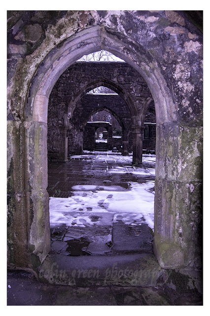
The pictures I took were in the gardens, they show the magnificent of the hall on a cool December morning. They were taken using a Nikon d3300 on the 10th December 2022, they can also be seen in a higher resolution on my Clickasnap account.


Clicking the images should open a link in another window to a higher resolution version on Clickasnap. Please take a moment to view my Zazzle stores and Photo4Me profiles via the links below, I offer copies of my images on a number of different products there.


All the images remain the copyright of Colin Green.

Wednesday, 29 May 2024

A Walk in Winter: The Calder and Hebble Navigation

These black and white photos capture the stark beauty of a winter scene along the Calder and Hebble Navigation. The path, blanketed in snow, winds its way alongside a still waterway. The trees lining the bank are bare, their branches reaching out like skeletal fingers towards the inky sky.

The absence of color in this photo only heightens the sense of tranquility. The world seems hushed, blanketed in a peaceful silence. Footprints visible in the snow are likely those of lonely hikers, making the viewer feel as though they are a remote person in this isolated landscape.

The Calder and Hebble Navigation is a 21-mile canal in West Yorkshire, England. It was built in the late 18th century to connect Sowerby Bridge with Wakefield. Today, the canal is a popular spot for walking, cycling, and boating.

This photo is a reminder that even in the depths of winter, there is beauty to be found in the natural world. The stark contrast of the black and white tones highlights the simple elegance of the scene. The stillness of the river and the bare branches of the trees create a sense of peace and tranquility.

If you're looking for a place to escape the hustle and bustle of everyday life, the Calder and Hebble Navigation is a great option. A walk along the canal towpath is a chance to connect with nature and appreciate the beauty of the season, whatever the weather.

In addition to its natural beauty, the Calder and Hebble Navigation is also steeped in history. The canal was an important transportation artery during the Industrial Revolution, and there are a number of old mills and warehouses along its banks. Today, these buildings have been converted into homes, businesses, and arts centers.

Whether you're interested in history, nature, or simply looking for a place to relax, the Calder and Hebble Navigation is a great place to visit. So next time you're in West Yorkshire, be sure to take a walk along this historic waterway. You might just be surprised by the beauty you find.

The pictures below were taken on the 17th January 2016 with a Nikon D3300 Camera, they can also be seen in a higher resolution on Clickasnap, by simply clicking any of the images. All will open in another window.

The canal pictured looking away from Walker Lane Bridge towards Chain Bridge. The Sowerby Bridge Gas Works and Gasometers used to occupy a site to the left of the picture just beyond the trees, the gasometers have long since been removed.

The canal is pictured here between Hollas Lane Bridge (Sterne Mills Bridge) and Edwards Road Bridge (Canal Mills Bridge). Both Bridges tend to known by either name, the land to the left of the picture has been redeveloped in to Copley Valley a mixed use zone of housing, industry and nature areas since this picture was taken. The land to the right of the picture may also face redevelopment in the coming years, it was for a number of years a car park for the Halifax Bank's Copley Data Centre, this has been closed for a while now with the data set to close and be sold off in the near future.

The canal towards Mearclough Canal Bridge, the waterway narrows a little here, often wondered why.

Clicking any image should open a link to the version on Clickasnap. Various images and products of mine are avaliable to view and purchase from the sites below, clicking any link will open in another window.

All the images remain the copyright of Colin Green.


The following images are the colour versions of the pictures,


Sunday, 28 January 2024

Stoodley Pike November 2016

Towering over the Calder Valley, Stoodley Pike is more than just a hill overlooking the town of Todmorden, West Yorkshire; it's a monument; it's a beacon, a challenge, and a gateway to breathtaking panoramas. I embarked on my own Stoodley Pike adventure, and let me tell you, it was an experience in stunning vistas.

There are several routes to the summit, each offering its own unique charm. I opted for the Shaw Wood Road trail, starting from the A646 Burnley Road. The trail leaves Burnley Road almost immediately, crossing over the Rochdale Canal alongside Lock No. 15 Shawplains. The road winds through woodlands before reaching a housing estate at Lee Bottom Road, which runs eastward, offering glimpses of the imposing Pike as you ascend. Be prepared for a good workout, as the trail steadily gains elevation.

Finally, after conquering the final incline, the reward arrives. The 39-step spiral staircase beckons, leading you up another 40 feet to the balcony of the monument. Remember, a torch is recommended, as the narrow passage plunges into darkness, despite a grill that is meant to offer a light source.

The views from the top are nothing short of magnificent. The hill, at a height of 1300 feet, shows rolling fields in every direction, dotted with villages, reservoirs, and the distant Pennine peaks. On a clear day, you can even see Manchester and the Irish Sea! Take a deep breath, soak it all in, and feel the sense of accomplishment wash over you.

But Stoodley Pike is more than just a scenic overlook. It's steeped in history, dating back to the Iron Age. Explore the monument's intriguing inscriptions and weathered stones, whispering tales of the past. A monument was originally built to commemorate the Napoleonic Wars and then rebuilt to remember the Crimean War.

The monument features the following faded inscription above the north facing door:

STOODLEY PIKE
A BEACON MONUMENT
ERECTED BY PUBLIC SUBSCRIPTION
COMMENCED IN 1814 TO COMMEMORATE
THE SURRENDER OF PARIS TO THE ALLIES
AND FINISHED AFTER THE BATTLE OF
WATERLOO WHEN PEACE WAS ESTABLISHED IN 1815.
BY A STRANGE COINCIDENCE
THE PIKE FELL ON THE DAY THE RUSSIAN
AMBASSADOR LEFT LONDON BEFORE THE
DECLARATION OF WAR WITH RUSSIA IN 1854.
WAS REBUILT WHEN PEACE WAS RESTORED IN
1856.
RESTORED AND LIGHTNING CONDUCTOR FIXED IN
1889.
 
The pictures below were taken on the 19th November 2016 with a Nikon D3300; they can be seen un-watermarked on my Clickasnap portfolio. Click any image to view it there.

The path up to Stoodley Pike, the monument visible at the summit.

I think the snow clinging to the side of the structure gives the monument a completely different feel to its usual look.


The Calder Valley and beyond towards Lancashire, taken from the base of the monument.

Looking west away from the monument, I have always liked this picture as it's gives the impression the clouds will shortly fall over the edge of the hill.

Thanks for looking, please take a moment to share and follow me on social media, you can also check out my Zazzle stores and Photo4Me portfolio via the links below.


All the pictures remain the copyright of Colin Green.

Saturday, 21 October 2023

Christ Church, Sowerby Bridge

 Christ Church is an Anglican place of worship in the town of Sowerby Bridge, West Yorkshire. Built in 1821 by John Oates to replace Brigg Chapel which had stood alongside the River Calder since 1526, the church was the result of over 20 years of fundraising to build the new place of worship for the growing town. Despite completion in 1821 Christ Church was not consecrated until 1824. It has been remodelled, extended and refurbished a number of times, lastly in 1895 after a fire gutted the chancel, roof and organ. 

A number of items inside the church have been taken from nearby churches and chapels after they were closed. The graveyard was closed in 1857 by order of the Secretary to Queen Victoria, due to fears of disease, despite this burials are said to have continued until 1960 with John Eddie Bottomley (1879-1960) the last known burial at Christ Church.

I took these pictures on the 18th March 2018 with a Nikon d3300.

The junction pictured used to be part of the Rochdale Canal, the church tower overlooking lock number 3. This was infilled sometime in the late 1940's. early 1950's and Tuel Lane built over it. The canal was reopened in 1996 when a tunnel was built underneath the junction and lock 3 and 4 were replaced by the deepest canal lock in the United Kingdom a short distance further west than the original lock 3.

The steps in front of the church are a recent edition, the road being recently widened here. The clock was added in 1839.


This picture would not have been possible for a number of years, the view would have been blocked by York House, a block of maisonette's that suffered from a poor reputation. They were demolished around the turn of the millennium, the area now overgrown and abandoned.

Clicking any image should open a link in another window to the higher resolution, un-watermarked version on Clickasnap.

Thanks for looking, please take a moment to share and follow me on social media.

All the pictures remain the copyright of Colin Green.

Tuesday, 6 December 2022

Boxing Day Randoms.

 A set here I took using a Samsung Galaxy Tablet on Boxing Day 2013, whilst out for a walk blowing away the Christmas Day cobwebs. Not much to add only they were taken in the Sowerby Bridge to Luddendenfoot area.


I've never discovered much about this building, it can be found by following a path from Tenterfields in the direction of Boulderclough and Luddendenfoot. I was once told it was part of Sagar Richards, which was an engineering company that occupy a sight to the north of the railway which passes to the right of the picture. There's no obvious signs that the sites were connected at the railway crossers a low bridge to the west of here which would have restricted access to larger vehicles.


This former mill pulley is on display in an apartment complex that occupies the former mills in the centre of Sowerby Bridge. Dugdales Mill can be seen in the background.


This stream runs through a private garden at Rose Grove to the west of Sowerby Bridge, the stream runs underneath the road in to the Rochdale Canal.


This former mill chimney long since disused offers a striking site in the centre of Sowerby Bridge, the road that runs past is the Old Cawsey an ancient packhorse route that was once the main road through the valley and Sowerby Bridge.


The 3 pictures above show Monkey Tunnel (no idea why it's called that). The tunnel runs underneath the railway line near Tenterfields Business Park.


Now offices and apartments this building was once the boiler house that helped Sowerby Bridge power that industry that built it from a hamlet alongside the River Calder into a town.


These rusty gates can be found near Trinity Academy, Sowerby Bridge, they were probably once one of the entrances to the school grounds, they have long since ceased to be used and have been left to rot, rust and decay.


This water culvert carries a water source from Sowerby underneath the railway in to the River Calder, it can be found near the red brick abandoned mill pictured earlier.


Willow Hall Drive is a private road that takes it's name from the nearby manor house. Despite being a private road it is accessible to cars and pedestrians.


The tree lined partially covered path leads up from the Hollins Mill area to the Friendly area of Sowerby Bridge.

Thanks for looking and please take a moment to share and follow me on social media.

Clicking any image should open a link in another window to the higher resolution version on Clickasnap.

All the pictures remain the copyright of Colin Green.

Thursday, 30 December 2021

The Ruins of the Church of St Thomas a' Becket

 Built sometime in late 12th - early 13th Century, the Heptonstall Parish Church was known as the Church of St Thomas a' Becket. It was also known as the chapel The Chapel of St Thomas the Martyr. It was built to serve the communities of Heptonstall, Erringden, Langfield, Stansfield and Wadsworth. The Priests were appointed and paid for by the Vicar of Halifax as the church was to serve the people to the west of Halifax.

The church was closed for a time around the turn of the 16th Century due to the murder of a priest, it was said he had performed an illicit marriage ceremony. The church underwent renovations in the 14th, 15th, 16th and 17th centuries, and a new clock was installed in 1810. This was moved to the new church.

The church was damaged by a storm in 1847 which tore off the roof, damaged the tower and caused considerable damage to the churchyard. The church rate, a tax payable by all parishioners to support the parish church was insufficient to repair the damage. A new church was built in the same churchyard funded by voluntary subscription and this opened in 1854.

The church ruins still stand to this day and occasionally outdoor services are conducted in the remains of the St Thomas a' Becket. I took these pictures on the 19th November 2016 with a Nikon d3300, they can also be seen un-watermarked and higher resolution on Clickasnap. Click any image and a link will open in another window.


Clicking any image will open a ink in another window to the un-watermarked, higher resolution version on Clickasnap.

Thanks for looking and please take a moment to share and follow me on social media.

All the pictures remain the copyright of Colin Green.

Through a Glass, Darkly: Hebden Bridge Railway Station in Negative

 There's something hauntingly beautiful about old photographs, especially when they're presented in a way that flips our perception....