Saturday, 24 June 2017

Top Withins: The Inspiration for Wuthering Heights

The abandoned farmstead of Top Withins is said to have been the inspiration for Emily Brontë's novel Wuthering Heights. There is a plaque at the ruins that reads,

"This farmhouse has been associated with "Wuthering Heights", the Earnshaw home in Emily Brontë's novel. The buildings, even when complete, bore no resemblance to the house she described, but the situation may have been in her mind when she wrote the moorland setting of the Heights."

  • Bronte Society, 1964. This plaque has been placed here in response to many inquiries.

The farm was thought to have been built in the 2nd half of the 16th century and was lived in by the Sunderland family when the novel was published in 1847. The last known inhabitant was Ernest Reddy in 1926.

Top Withins: A Haunting Reminder of the Past

Top Withins is a ruined farmhouse located on the windswept moors of Yorkshire, England. It is said to have been the inspiration for Emily Brontë's Wuthering Heights, the classic novel of love, loss, and revenge.

The farmhouse is a haunting reminder of the past, its stone walls crumbling and its windows boarded up. But even in its dilapidated state, it still holds a certain magic.

Visiting Top Withins

Top Withins is a popular destination for fans of Wuthering Heights, as well as for those who simply enjoy the beauty of the Yorkshire Moors.

The farmhouse is located about 3 miles from Haworth, the village where the Brontë sisters lived. It is a short walk from the Brontë Waterfall, another popular tourist destination.

If you are planning to visit Top Withins, be sure to wear sturdy shoes and bring a jacket, as the weather can be unpredictable on the moors.

The History of Top Withins

Top Withins was built in the 16th century. It was originally a working farm, but it was abandoned in the early 20th century.

The farmhouse is now owned by the National Trust. It is open to the public, but it is not possible to go inside.

The Legend of Top Withins

There are many legends associated with Top Withins. One legend says that the farmhouse is haunted by the ghost of Emily Brontë. Another legend says that the farmhouse is built on the site of an ancient pagan temple.

Whether you believe in the legends or not, there is no denying that Top Withins is a truly magical place.

Conclusion

Top Withins is a must-visit destination for any fan of Wuthering Heights. It is also a great place to enjoy the beauty of the Yorkshire Moors.

If you are planning a trip to Yorkshire, be sure to add Top Withins to your list.

The pictures were taken using a Polaroid iS2132 camera in March 2014, clicking any image below should open a link in another window to my Colin Green Photography store on Zazzle.


Thanks for looking, and please take a moment to share and follow me on social media and check out my portfolio on Photo4Me via the link below.


All the pictures remain the copyright of Colin Green.

Thursday, 8 June 2017

Wainhouse Tower: A Monument to Spite (and Stunning Views)

Standing proud atop King Cross, overlooking Halifax, West Yorkshire, Wainhouse Tower isn't your average landmark. This magnificent folly, soaring to a dizzying 275 feet, holds the title of the tallest folly in the world. A climb of 403 steps to the lower viewing area rewards visitors with breathtaking panoramic views across the Calder Valley – a vista well worth the small entrance fee charged on bank holidays.

But Wainhouse Tower's story is far more intriguing than just its impressive height. Originally conceived as a chimney for the Washer Lane Dye Works, the tower's fate took a dramatic turn when the works manager, upon purchasing the business, balked at the cost of the towering chimney. Enter John Edward Wainhouse, a man with a vision… and perhaps a touch of spite.

Legend has it that Wainhouse harbored a long-standing feud with his neighbor, Sir Henry Edwards, whose estate was renowned for its privacy. Wainhouse, determined to ensure Edwards could never again claim such seclusion, transformed the unfinished chimney into a magnificent viewing tower. And so, the tale of the "Tower of Spite" was born. Whether fuelled by genuine animosity or simply a touch of playful rivalry, Wainhouse poured £14,000 into the project (equivalent to over £1.1 million today!), completing it in 1875.

While the "Tower of Spite" story adds a colourful layer to its history, Wainhouse Tower has served a more practical purpose over the years. It came under the ownership of Halifax Corporation in 1919, served as an observation post during World War II, and finally became the property of Calderdale Council in 1974. Today, it stands as a testament to Victorian ingenuity, a quirky reminder of local rivalries, and, most importantly, a fantastic vantage point for appreciating the beauty of the Calder Valley. So, if you're ever in Halifax on a bank holiday, be sure to make the climb – the views (and the story) are truly unforgettable.

These pictures were taken on various dates during the year 2016. They were taken using a Nikon d3300 SLR camera. Clicking any image should open a link in another window to my Colin Green Photography store on Clickasnap.


The tower pictured from Albert Prom, or The Rocks as it's known locally.


The large building to the front is Halifax Bank's Copley Data Centre, built in the 1980s. The data centre is due to close in the next few years.

 Thanks for looking; please take a moment to share and follow me on social media and check out my portfolio on Photo4Me via the link below.


All the pictures remain the copyright of Colin Green.

Sunday, 4 June 2017

The Halifax Branch of the Calder & Hebble Canal: A Lost Waterway

Just a whisper of its former self, the Halifax Branch of the Calder & Hebble Canal now stretches a mere half-mile from Salterhebble Junction and its locks to the Watermill Bar at Salterhebble Wharf. This truncated remnant is all that remains of a once vital artery that pulsed with industrial life.

Opened in 1828, the canal climbed a formidable 14 locks to its original terminus at Bailey Hall, a location now occupied by the bustling train station and the interactive Eureka! museum. Imagine the scene: barges laden with goods, lock keepers busy at their work, and the constant hum of industry. But the rise of the iron horse and the advent of tarmac roads spelled the canal's decline. By 1942, the upper section, from Salterhebble Wharf to Bailey Hall, was abandoned, its waters drained and its towpaths reclaimed. Today, the Hebble Trail, a popular cycle and pedestrian route, winds its way along the canal's former path, offering little hint of the waterway that once flowed there.

While whispers of reopening this lost stretch occasionally surface, fueled by hopes of boosting Halifax's tourism, such dreams face a stark reality. A more visionary local council might seize the opportunity to resurrect this historic waterway, but with tight budgets and a perceived lack of ambition, the chances of seeing barges once again navigating through the heart of Halifax seem, sadly, remote.

The pictures were taken on April 9, 2017, using a Nikon D3300 camera. Clicking any image should open a link in another window to my Colin Green Photography store on Zazzle.
The start of the Halifax Branch, Salterhebble Locks are just to the
left of the picture out of sight. The bridge in the distance carries the
Halifax - Brighouse stretch of railway and crossers the canal which is
heading in the direction of Sowerby Bridge.


Wakefield Road Bridge. The canal brakes off to the left just beyond the bridge
through Salterhebble Locks in the direction of Brighouse.

The abutment to the right used to support a bridge that crossed the
canal here. The bridge has long since been removed.


Salterhebble Moorings can be seen in the distance. Tihs
is where the canal now ends.


To the right of the Watermill Bar is Salterhebble Tunnel. The canal continued through
 there and immediately entered lock 1 of the 14 on exiting the tunnel. The stone lock
walls can still be seen.

The modern day end of the Halifax Branch Canal. The Watermill Bar and
 Restaurant occupies what was the site of Salterhebble Mills. There is
also a Premier Inn hotel on the site,


Thanks for looking, and please take a moment to share and follow me on social media and check out my portfolio on Photo4Me via the link below.

 
All the pictures remain the copyright of Colin Green.

Saturday, 27 May 2017

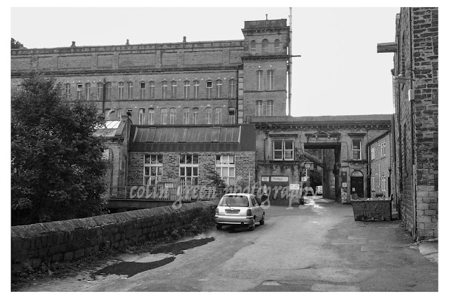
Asquith Bottom Mill, Sowerby Bridge November 2013

The sprawling Asquith Bottom Mill, a vibrant mixed-use industrial estate in Sowerby Bridge, West Yorkshire, has a rich and varied past woven into its very fabric. Built around the bones of a former industrial giant, the complex has housed everything from carpet manufacturing to wire drawing and woollen production, depending on which era you're talking about. Originally established by William Edleston, the mill held a prominent place in the town's landscape. I can still vividly recall the striking red neon Edleston sign emblazoned across the roof in the 1980s – a nostalgic beacon that, sadly, is no more. The mill's hum fell silent sometime in the late 80s or early 90s, marking the end of an era for this local landmark
 
The pictures below were taken in November 2013 using a Samsung Galaxy Tablet. Clicking any image should open a link in another window to my Colin Green Photography store on Zazzle.


Thanks for looking, and please take a moment to share and follow me on social media and check out my portfolio on Photo4Me via the link below.


All the pictures remain the copyright of Colin Green.

Saturday, 8 April 2017

Peñas del Cache: Lanzarote's Majestic Summit

Peñas del Cache, reaching a height of 672 meters above sea level, offers the highest panoramic views on the island of Lanzarote. This popular destination attracts both stargazers, drawn to the clear, dark skies, and sightseers eager to witness the breathtaking vistas stretching across the island and the vast Atlantic Ocean. The name "Peñas del Cache" is believed to originate from the Guanche language, the language of Lanzarote's original inhabitants, and is thought to mean simply "the height."

While a military observation post slightly higher than the public viewing area overlooks Peñas del Cache, access to this post is restricted. The readily accessible viewing point is located in the northern part of the island, within the municipality of Haría.

Geologically, Peñas del Cache is a stratovolcano, a formation built up over millennia by layers of hardened lava and tephra (volcanic ash). Scientists estimate its formation occurred during the Miocene period, which spanned approximately 5 to 23 million years ago. Adding to the area's rich history, archaeological evidence of the Majos, the ancient inhabitants of Lanzarote, has been discovered near Peñas del Cache, offering a glimpse into the island's past.

 
These pictures were taken in July 2013 with my Samsung Galaxy tablet. Clicking any picture below should open a link in another window to my Colin Green Photography Zazzle store.
The Atlantic ocean which surrounds Lanzarote can be seen down at
sea level.


Here is a short film set to music from my YouTube channel taken form the view point.


Please take a moment to share and follow me on social media and view my portfolio on Photo4Me via the link below.


Sunday, 8 January 2017

Fartown Rugby and Cricket Grounds, Huddersfield.

Fartown, originally known as St. John's Ground, has a rich sporting history that spans from cricket to rugby league. Its story begins in 1868, hosting cricket matches. In 1875, a pivotal merger took place, uniting Huddersfield St. John's Cricket Club with Huddersfield Athletic Club, which had already established a rugby club in 1866. This union laid the groundwork for Fartown's future as a rugby stronghold. By November 2nd, 1878, the ground had been sufficiently developed to host its first rugby match, a contest against the Manchester Rangers Rugby Club.

Fartown's significance in rugby history was further cemented in 1895 when the sport underwent a major split. Huddersfield joined the Northern Rugby Football Union, the breakaway faction that eventually evolved into the modern game of rugby league. Fartown became their home ground, a relationship that would last for nearly a century.

For almost a hundred years, Fartown echoed with the roar of the crowd and the clash of tackles. Its most glorious moment likely came in 1947 when it hosted a Challenge Cup Semi-Final, packing in over 35,000 spectators – a testament to the ground's capacity and the passion for rugby league in Huddersfield.

However, the stadium's fortunes began to decline in the 1980s. Despite its illustrious past, Fartown fell into disrepair. In 1992, Huddersfield Rugby League Football Club moved to the Leeds Road Stadium, marking the end of an era. Shortly after their departure, Fartown was demolished, erasing much of its physical presence. Today, only the floodlights, perimeter fencing, and the pitch itself remain as silent witnesses to the stadium's vibrant past, a reminder of the thousands of fans and the countless sporting memories forged within its boundaries. Fartown's story, though its stands may be gone, continues to resonate within the history of Huddersfield and the story of rugby league. 

These pictures were taken on June 18, 2015, with my Polaroid iS2132 digital camera. Clicking any image should open a link in another window to my Colin Green Photography store on Zazzle.

The Cricket Memorial, it used to feature a clock that has been removed.

The former cricket ground, now playing host to amateur Rugby League.

Taken from the Scoreboard terrace at the ground.

The very overgrown northern terrace.


The rather sad looking former cricket pavilion.

The scoreboard end, the stadiums metal fencing still in place.

Please take a moment to follow me on social media and check out mu portfolio on Photo4Me via the link below.

All the images remain the copyright of Colin Green, Thanks for looking.

Through a Glass, Darkly: Hebden Bridge Railway Station in Negative

 There's something hauntingly beautiful about old photographs, especially when they're presented in a way that flips our perception....